|
search place name
|
||
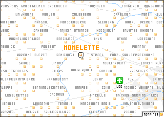
Momelette (Liège, Belgium)Momelette is a town in the Liège region of Belgium. An overview map of the region around Momelette is displayed below.
regional and 3d topo map of Momelette, Belgium ::
Momelette airports ::
The nearest airport is LGG - Liege, located 7.4 km south east of Momelette.
Other airports nearby include MST - Maastricht (38.1 km north east), GKE - Geilenkirchen (56.7 km north east), BRU - Brussels Natl (Melsbroek) (66.8 km west), CRL - Charleroi Brussels South (69.3 km west), Nearby towns ::
Crèvecoeur (0.0km north) //
Momalle (1.2km east) //
Noville (2.2km south east) //
Fize-le-Marsal (2.2km north east) //
Fize (2.2km north east) //
Hodeige (2.2km north west) //
Streel (2.3km east) //
Jeneffe (3.7km south) //
Malplaquet (3.7km south) //
Lamine (2.3km west) //
Remicourt (2.3km west) //
Fexhe-le-Haut-Clocher (3.0km south east) //
Le Soleil (3.9km south) //
Grandville (3.9km north) //
Lens-sur-Geer (3.9km north) //
Roloux (4.4km south east) //
Aux Croix (4.4km north east) //
Crisnée (4.4km north east) //
Thys (4.4km north east) //
Bergilers (4.4km north west) //
Oreye (5.6km north) //
Otrange (5.6km north) //
Freloux (3.5km east) //
Brouck (5.7km north) //
Limont (4.0km south west) //
Horion-Hozémont (5.7km south) //
Kemexhe (4.0km north east) //
Odeur (4.0km north east) //
Nomerange (6.0km north east) //
[all distances 'as the bird flies' and approximate]  Places with similar names to Momelette, Belgium ::
Disclaimer :: Information on this page comes without warranty of any kind |
||
|
Where is Momelette? Elevation and coordinates ::
Latitude (lat): 50°41'0"N Longitude (lon): 5°22'0"E
Elevation (approx.): 132m (map arrows pan, magnifying glasses zoom) |
||
|
Visiting Momelette? Hotel/Accommodation ::
Book a hotel in Momelette Travel Guide ::
Buy a travel guide for Belgium rental cars ::
car rental offers GPS waypoint ::
download a GPX waypoint (PoI) of Momelette for your GPS receiver
|
||