|
search place name
|
||
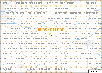
Oud Smetlede (Oost-Vlaanderen, Belgium)Oud Smetlede is a town in the Oost-Vlaanderen region of Belgium. An overview map of the region around Oud Smetlede is displayed below.
regional and 3d topo map of Oud Smetlede, Belgium ::
Oud Smetlede airports ::
The nearest airport is BRU - Brussels Natl (Melsbroek), located 40.6 km east of Oud Smetlede.
Other airports nearby include ANR - Antwerp Deurne (45.4 km north east), QKT - Kortrijk-vevelgem Wevelgem (52.8 km west), WOE - Woensdrecht (61.4 km north east), CRL - Charleroi Brussels South (68.0 km south east), Nearby towns ::
Bril (0.0km north) //
Smetlede (0.0km north) //
Blekte (0.0km north) //
Kouter (0.0km north) //
Molenhoek (0.0km north) //
Schildeken (1.2km east) //
Ramschouw (1.2km east) //
Serskamp (1.9km north) //
Uilenbroekdries (1.9km south) //
Papegem (1.9km south) //
Strijmeers (1.9km south) //
Schoot (1.2km west) //
Speurtdries (1.2km west) //
Rot (1.2km west) //
Klinkaart (1.2km west) //
ʼt Wolfgat (2.2km north east) //
Boskant (2.2km north west) //
Kortenbos (2.2km north west) //
Oordegem (2.2km south west) //
Hoging (2.2km south west) //
Nessestraat (2.3km east) //
Impe (2.3km east) //
Opsmeer (2.3km east) //
Wanzele (2.3km east) //
Ledezijde (2.3km east) //
Ertbrug (3.7km north) //
Zonnegem (3.7km south) //
Hoeksken (3.7km south) //
Heet (3.7km south) //
[all distances 'as the bird flies' and approximate] 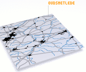 Places with similar names to Oud Smetlede, Belgium :: Disclaimer :: Information on this page comes without warranty of any kind |
||
|
Where is Oud Smetlede? Elevation and coordinates ::
Latitude (lat): 50°58'0"N Longitude (lon): 3°55'0"E
Elevation (approx.): 27m (map arrows pan, magnifying glasses zoom) |
||
|
Visiting Oud Smetlede? Hotel/Accommodation ::
Book a hotel in Oud Smetlede Travel Guide ::
Buy a travel guide for Belgium rental cars ::
car rental offers GPS waypoint ::
download a GPX waypoint (PoI) of Oud Smetlede for your GPS receiver
|
||