|
search place name
|
||
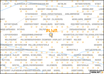
Plijn (Antwerpen, Belgium)Plijn is a town in the Antwerpen region of Belgium. An overview map of the region around Plijn is displayed below.
regional and 3d topo map of Plijn, Belgium ::
Plijn airports ::
The nearest airport is ANR - Antwerp Deurne, located 22.0 km west of Plijn.
Other airports nearby include WOE - Woensdrecht (38.1 km north west), BRU - Brussels Natl (Melsbroek) (41.9 km south west), EIN - Eindhoven (48.7 km north east), MST - Maastricht (78.9 km south east), Nearby towns ::
Berkven (NaNkm north) //
Klissenhoek (1.9km south) //
ʼt Zand (2.2km south east) //
Visplukt (2.2km south east) //
Moleneinde (2.2km south west) //
Strateneinde (2.2km south west) //
Pallaaraard (2.2km south west) //
Zegbroek (2.2km south west) //
Niemandshoek (2.2km south west) //
Moereinde (2.2km north east) //
Zalfenseheide (2.2km north west) //
Goorbergen (3.7km south) //
Vorselaar (3.7km south) //
Wechelderzande (3.7km north) //
Bruul (3.7km north) //
Broekzijde (3.0km north east) //
Lovenhoek (3.0km south west) //
Krabbels (3.0km south west) //
Boshoven (3.0km south west) //
Borgt Driesen (3.9km north) //
Beulk (3.9km north) //
Molenheide (3.9km north) //
Sept (3.9km north) //
Middelburg (3.9km north) //
Bruulbergen (3.9km north) //
Het Heiken (4.4km south east) //
Klein Eisterle (4.4km south west) //
Zand (4.4km north east) //
Raffendonk (4.4km north west) //
[all distances 'as the bird flies' and approximate] 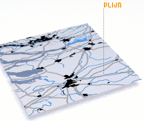 Places with similar names to Plijn, Belgium ::
Disclaimer :: Information on this page comes without warranty of any kind |
||
|
Where is Plijn? Elevation and coordinates ::
Latitude (lat): 51°14'0"N Longitude (lon): 4°46'0"E
Elevation (approx.): 22m (map arrows pan, magnifying glasses zoom) |
||
|
Visiting Plijn? Hotel/Accommodation ::
Book a hotel in Plijn Travel Guide ::
Buy a travel guide for Belgium rental cars ::
car rental offers GPS waypoint ::
download a GPX waypoint (PoI) of Plijn for your GPS receiver
|
||