|
search place name
|
||
Rhées (Liège, Belgium)Rhées is a town in the Liège region of Belgium. An overview map of the region around Rhées is displayed below.
regional and 3d topo map of Rhées, Belgium ::

Rhées airports ::
The nearest airport is LGG - Liege, located 13.3 km south west of Rhées.
Other airports nearby include MST - Maastricht (27.6 km north east), GKE - Geilenkirchen (43.0 km north east), BRU - Brussels Natl (Melsbroek) (83.4 km west), CRL - Charleroi Brussels South (86.1 km west), Nearby towns ::
La Préalle (1.9km south) //
Pontisse (1.2km east) //
Bernalmont (1.9km south) //
Herstal (2.2km south east) //
Tribouillet (2.2km south west) //
Rogivaux (2.2km south west) //
Jolivet (2.2km south west) //
Vaux (2.2km north east) //
Milmort (2.2km north west) //
Coronmeuse (3.7km south) //
Hermée (3.7km north) //
Grand Aaz (3.7km north) //
Broux (3.7km north) //
Vottem (2.3km west) //
Hareng (2.3km west) //
Werihet (3.0km south east) //
Wandre (3.0km south east) //
La Xhavée (3.0km south east) //
Le Dossay (3.0km south east) //
Souverain Wandre (3.0km south east) //
Jupille (3.9km south) //
Tournay (3.0km north east) //
Vivegnis (3.0km north east) //
Les Trixhes (3.0km north east) //
Oupeye (3.0km north east) //
Saint-Léonard (3.9km south) //
Petit Aaz (3.9km north) //
La Vaux (3.9km north) //
Au Chenay (3.9km north) //
[all distances 'as the bird flies' and approximate] 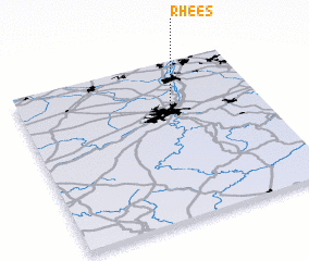 Places with similar names to Rhées, Belgium ::
Disclaimer :: Information on this page comes without warranty of any kind |
||
|
Where is Rhées? Elevation and coordinates ::
Latitude (lat): 50°41'0"N Longitude (lon): 5°37'0"E
Elevation (approx.): 140m (map arrows pan, magnifying glasses zoom) |
||
|
Visiting Rhées? Hotel/Accommodation ::
Book a hotel in Rhées Travel Guide ::
Buy a travel guide for Belgium rental cars ::
car rental offers GPS waypoint ::
download a GPX waypoint (PoI) of Rhées for your GPS receiver
|
||