|
search place name
|
||
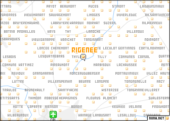
Rigenée (Brabant, Belgium)Rigenée is a town in the Brabant region of Belgium. An overview map of the region around Rigenée is displayed below.
regional and 3d topo map of Rigenée, Belgium ::
Rigenée airports ::
The nearest airport is CRL - Charleroi Brussels South, located 12.8 km south of Rigenée.
Other airports nearby include BRU - Brussels Natl (Melsbroek) (37.3 km north), LGG - Liege (66.1 km east), ANR - Antwerp Deurne (69.4 km north), MST - Maastricht (96.4 km north east), Nearby towns ::
Thyle (1.2km west) //
Marbais (1.9km south) //
Tribotte (2.2km north east) //
Hollers (2.2km north east) //
Villers-la-Ville (2.2km north east) //
Riz dʼHez (2.2km north west) //
Lambiernoux (2.2km south west) //
Rualette (2.2km south west) //
Tilly (2.4km east) //
Le Cerisier (3.7km north) //
Monceau du Berger (3.7km south) //
Houlette (2.4km west) //
Sart-Dames-Avelines (2.4km west) //
Strichon (3.0km north east) //
Basse Heuval (3.0km north east) //
Le Chête (3.9km north) //
Tangissart (3.9km north) //
Marbisoux (3.0km south east) //
Fosty (3.9km north) //
La Croisette (3.0km north west) //
Chechy (3.0km south west) //
Pavé (3.0km south west) //
Brye (4.4km south east) //
Warichet (4.4km north west) //
La Falise (4.4km north west) //
Cheniat (4.4km north west) //
Bon Air (4.4km north west) //
Hattain (4.4km north west) //
Wagnelée (5.6km south) //
[all distances 'as the bird flies' and approximate] 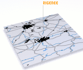 Places with similar names to Rigenée, Belgium ::
Disclaimer :: Information on this page comes without warranty of any kind |
||
|
Where is Rigenée? Elevation and coordinates ::
Latitude (lat): 50°34'0"N Longitude (lon): 4°31'0"E
Elevation (approx.): 134m (map arrows pan, magnifying glasses zoom) |
||
|
Visiting Rigenée? Hotel/Accommodation ::
Book a hotel in Rigenée Travel Guide ::
Buy a travel guide for Belgium rental cars ::
car rental offers GPS waypoint ::
download a GPX waypoint (PoI) of Rigenée for your GPS receiver
|
||