|
search place name
|
||
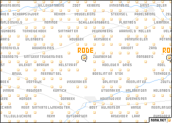
Rode (Brabant, Belgium)Rode is a town in the Brabant region of Belgium. An overview map of the region around Rode is displayed below.
regional and 3d topo map of Rode, Belgium ::
Rode airports ::
The nearest airport is BRU - Brussels Natl (Melsbroek), located 31.6 km west of Rode.
Other airports nearby include LGG - Liege (45.2 km south east), ANR - Antwerp Deurne (47.5 km north west), CRL - Charleroi Brussels South (58.1 km south west), MST - Maastricht (59.0 km east), Nearby towns ::
Attenrode (1.2km west) //
Kapellen (1.2km east) //
Meensel-Kiezegem (1.9km north) //
Wever (2.2km south west) //
Glabbeek-Zuurbemde (2.2km south east) //
Meerlenest (2.2km north east) //
Bunsbeek (3.7km south) //
Zuurbemde (2.3km east) //
Heiblok (3.7km north) //
Groenendries (3.0km south west) //
Helstraat (3.0km south west) //
Kiezegem (3.0km north west) //
Woubeek (3.9km north) //
Driesstraat (3.9km north) //
Craasbeek (3.9km north) //
Netelzeep (3.0km north east) //
Molenbeek-Wersbeek (3.9km north) //
Muggenberg (3.9km north) //
Boeslinter (4.4km south east) //
Pepinusfort (4.4km south east) //
Koeigat (4.4km north east) //
Wersbeek (4.4km north east) //
Sint-Martens (5.6km south) //
Hulst (3.5km west) //
Vissenaken (5.7km south) //
Binkom (4.0km south west) //
Hoeleden (4.0km south east) //
Heuvel (5.7km north) //
Kattebeek (4.0km north east) //
[all distances 'as the bird flies' and approximate] 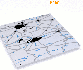 Places with similar names to Rode, Belgium ::
Disclaimer :: Information on this page comes without warranty of any kind |
||
|
Where is Rode? Elevation and coordinates ::
Latitude (lat): 50°53'0"N Longitude (lon): 4°56'0"E
Elevation (approx.): 72m (map arrows pan, magnifying glasses zoom) |
||
|
Visiting Rode? Hotel/Accommodation ::
Book a hotel in Rode Travel Guide ::
Buy a travel guide for Belgium rental cars ::
car rental offers GPS waypoint ::
download a GPX waypoint (PoI) of Rode for your GPS receiver
|
||