|
search place name
|
||
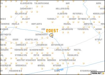
Roest (Antwerpen, Belgium)Roest is a town in the Antwerpen region of Belgium. An overview map of the region around Roest is displayed below.
regional and 3d topo map of Roest, Belgium ::
Roest airports ::
The nearest airport is EIN - Eindhoven, located 22.2 km north east of Roest.
Other airports nearby include ANR - Antwerp Deurne (48.5 km west), WOE - Woensdrecht (55.4 km west), BRU - Brussels Natl (Melsbroek) (65.3 km south west), MST - Maastricht (65.5 km south east), Nearby towns ::
Goreheide (1.9km south) //
Wampenberg (1.2km west) //
Kruikeven (1.9km north) //
Langschelpen (1.9km north) //
Ravelsehoek (2.2km north west) //
Voorheide (2.2km north west) //
Den Heikant (2.3km west) //
Wateringen (3.9km south) //
Kattenbosch (3.0km north east) //
Lensheuvel (3.0km north east) //
Voorste Heikant (3.0km north east) //
De Hoek (3.0km north east) //
Achterste Heikant (3.0km north east) //
De Huiskens (3.9km south) //
Beerendonk (3.9km south) //
Arendonk (3.0km south west) //
Broekkant (3.0km south west) //
Kwade Putten (3.0km north west) //
Leeg Broek (4.4km south west) //
De Voort (4.4km north east) //
Holland (4.4km north east) //
Twisselt (5.6km north) //
Hooge Mierde (5.6km north) //
Den Lommelaar (5.6km south) //
Broekstraat (3.9km south west) //
Bergen (3.9km south west) //
Goorstraat (5.7km south) //
Plas (5.7km south) //
Kippereind (3.9km north east) //
[all distances 'as the bird flies' and approximate]  Places with similar names to Roest, Belgium ::
Disclaimer :: Information on this page comes without warranty of any kind |
||
|
Where is Roest? Elevation and coordinates ::
Latitude (lat): 51°20'0"N Longitude (lon): 5°7'0"E
Elevation (approx.): 28m (map arrows pan, magnifying glasses zoom) |
||
|
Visiting Roest? Hotel/Accommodation ::
Book a hotel in Roest Travel Guide ::
Buy a travel guide for Belgium rental cars ::
car rental offers GPS waypoint ::
download a GPX waypoint (PoI) of Roest for your GPS receiver
|
||