|
search place name
|
||
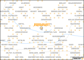
Rond Punt (Antwerpen, Belgium)Rond Punt is a town in the Antwerpen region of Belgium. An overview map of the region around Rond Punt is displayed below.
regional and 3d topo map of Rond Punt, Belgium ::
Rond Punt airports ::
The nearest airport is EIN - Eindhoven, located 35.0 km east of Rond Punt.
Other airports nearby include ANR - Antwerp Deurne (36.6 km south west), WOE - Woensdrecht (38.4 km west), BRU - Brussels Natl (Melsbroek) (60.4 km south west), RTM - Rotterdam (70.9 km north west), Nearby towns ::
Lipseinde (1.2km east) //
Het Geheul (1.2km east) //
Hoekeinde (2.2km south west) //
Merksplas (2.2km south west) //
Strikken (2.2km north west) //
Ginhoven (2.2km north west) //
Gel (2.2km north east) //
Wolfsputten (3.9km south) //
Koekhoven (3.9km south) //
Heikant (3.0km north west) //
De Kasteeltjes (3.0km south east) //
Ghil (3.0km north east) //
Zondereigen (3.9km north) //
Huizeneinde (4.4km south west) //
De Meren (5.6km south) //
Bieheide (3.5km east) //
Baarle Heide (3.5km east) //
Het Oosteneind (5.7km south) //
Baarle-Nassau-Grens (3.9km north east) //
Staakheuvel (3.9km north west) //
Hoogeind (5.7km north) //
Eikelenbosch (5.7km north) //
Gorpeind (5.7km north) //
Berkedonk Ven (5.1km south west) //
Heilaar (6.0km south west) //
Nieuwe Strumpt (6.0km north west) //
Nazaret (6.0km south east) //
Stokt (6.0km south east) //
Tommel (6.0km north east) //
[all distances 'as the bird flies' and approximate] 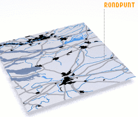 Places with similar names to Rond Punt, Belgium ::
Disclaimer :: Information on this page comes without warranty of any kind |
||
|
Where is Rond Punt? Elevation and coordinates ::
Latitude (lat): 51°23'0"N Longitude (lon): 4°53'0"E
Elevation (approx.): 25m (map arrows pan, magnifying glasses zoom) |
||
|
Visiting Rond Punt? Hotel/Accommodation ::
Book a hotel in Rond Punt Travel Guide ::
Buy a travel guide for Belgium rental cars ::
car rental offers GPS waypoint ::
download a GPX waypoint (PoI) of Rond Punt for your GPS receiver
|
||