|
search place name
|
||
Rostijne (Oost-Vlaanderen, Belgium)Rostijne is a town in the Oost-Vlaanderen region of Belgium. An overview map of the region around Rostijne is displayed below.
regional and 3d topo map of Rostijne, Belgium ::

Rostijne airports ::
The nearest airport is ANR - Antwerp Deurne, located 45.1 km east of Rostijne.
Other airports nearby include WOE - Woensdrecht (48.3 km north east), BRU - Brussels Natl (Melsbroek) (55.4 km south east), QKT - Kortrijk-vevelgem Wevelgem (57.9 km south west), OST - Oostende (66.8 km west), Nearby towns ::
Pachtgoed (0.0km north) //
Burgstraat (1.2km west) //
Mendonk (1.9km south) //
Groenstraat (1.9km south) //
Sint-Kruis-Winkel (1.9km south) //
Kloosterbos (2.2km north east) //
Hoek (2.2km north west) //
De Heide (2.2km north west) //
Warande (2.2km south east) //
Molenhoek (2.2km south west) //
Spaansveer (2.2km south west) //
Vierweegse (2.2km south west) //
Walderdonk (2.3km east) //
Pottersbrug (2.3km east) //
Zelzate (3.7km north) //
Rieme (2.3km west) //
Langelede (3.0km north east) //
Balkenbrug (3.0km north east) //
De Akker (3.9km north) //
Overlede ʼt Fort (3.0km south east) //
Laatstenstuiver (3.9km north) //
Kallemansputte (3.0km north west) //
Debboutshoek (3.0km north west) //
Speurdonk (3.9km south) //
Nerenhoek (3.9km south) //
Terdonk (3.0km south west) //
Sprendonk (3.9km south) //
Putteveld (3.9km south) //
Denderdreef (4.4km north west) //
[all distances 'as the bird flies' and approximate] 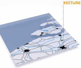 Places with similar names to Rostijne, Belgium ::
Disclaimer :: Information on this page comes without warranty of any kind |
||
|
Where is Rostijne? Elevation and coordinates ::
Latitude (lat): 51°10'0"N Longitude (lon): 3°49'0"E
Elevation (approx.): 7m (map arrows pan, magnifying glasses zoom) |
||
|
Visiting Rostijne? Hotel/Accommodation ::
Book a hotel in Rostijne Travel Guide ::
Buy a travel guide for Belgium rental cars ::
car rental offers GPS waypoint ::
download a GPX waypoint (PoI) of Rostijne for your GPS receiver
|
||