|
search place name
|
||
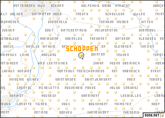
Schoppem (Liège, Belgium)Schoppem is a town in the Liège region of Belgium. An overview map of the region around Schoppem is displayed below.
regional and 3d topo map of Schoppem, Belgium ::
Schoppem airports ::
The nearest airport is MST - Maastricht, located 18.0 km north of Schoppem.
Other airports nearby include LGG - Liege (27.1 km south west), GKE - Geilenkirchen (29.7 km north east), MGL - Moenchengladbach Monchengladbach (73.6 km north east), EIN - Eindhoven (83.0 km north), Nearby towns ::
Vitchen (1.2km west) //
Verte Haie (1.9km south) //
Altembroek (1.9km north) //
Schoppemerheide (1.9km north) //
Fouron-le-Comte (2.2km north west) //
Snauwenberg (2.2km north west) //
ʼs Gravenvoeren (2.2km north west) //
Warsage (2.2km south west) //
Afnay (2.2km south west) //
La Heydt (2.2km south east) //
Fechereux (3.7km south) //
Les Waides (3.7km south) //
Fouron-Saint-Martin (2.3km east) //
Sint-Martens-Voeren (2.3km east) //
Berg (2.3km east) //
Quinten (2.3km east) //
Neufchâteau (3.9km south) //
Moerslag (3.9km north) //
Libeek (3.9km north) //
Bombaye (3.0km south west) //
Trois Cheminées (3.9km south) //
Mheer (3.9km north) //
Zwaan (3.0km south east) //
Waterval (3.0km south east) //
Sint-Pieters-Voeren (3.0km south east) //
Fouron-Saint-Pierre (3.0km south east) //
Noorbeek (3.0km north east) //
Vroelen (3.0km north east) //
Mortroux (4.4km south west) //
[all distances 'as the bird flies' and approximate] 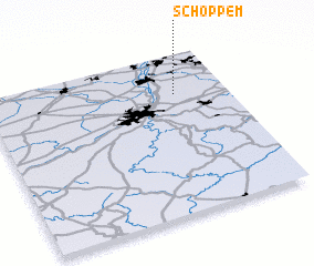 Places with similar names to Schoppem, Belgium ::
Disclaimer :: Information on this page comes without warranty of any kind |
||
|
Where is Schoppem? Elevation and coordinates ::
Latitude (lat): 50°45'0"N Longitude (lon): 5°47'0"E
Elevation (approx.): 128m (map arrows pan, magnifying glasses zoom) |
||
|
Visiting Schoppem? Hotel/Accommodation ::
Book a hotel in Schoppem Travel Guide ::
Buy a travel guide for Belgium rental cars ::
car rental offers GPS waypoint ::
download a GPX waypoint (PoI) of Schoppem for your GPS receiver
|
||