|
search place name
|
||
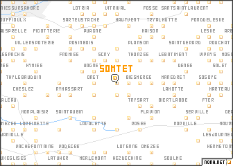
Somtet (Namur, Belgium)Somtet is a town in the Namur region of Belgium. An overview map of the region around Somtet is displayed below.
regional and 3d topo map of Somtet, Belgium ::
Somtet airports ::
The nearest airport is CRL - Charleroi Brussels South, located 22.5 km north west of Somtet.
Other airports nearby include LGG - Liege (67.7 km north east), BRU - Brussels Natl (Melsbroek) (67.9 km north), ANR - Antwerp Deurne (99.8 km north), MST - Maastricht (104.5 km north east), Nearby towns ::
La Follée (0.0km north) //
Cornelle (1.9km south) //
Fraire la Crotteuse (1.2km east) //
Hardimont (1.9km north) //
Stave (2.2km south east) //
Moulin de Stave (2.2km south east) //
Mettet (2.2km north east) //
Biesmerée (2.4km east) //
Oret (2.4km west) //
Les Croisettes (2.4km west) //
Pontaury (3.7km north) //
Corroy (3.0km south west) //
Wagnée (3.0km north west) //
Prée (3.0km north west) //
La Fayat (3.9km north) //
Scry (3.9km north) //
Try Sart (4.4km south east) //
Thorzée (4.4km north east) //
Biesme (4.4km north west) //
Planoy (4.4km north west) //
Nefsée (4.4km north west) //
Furnaux (3.6km east) //
Devant les Bois (5.6km north) //
Corenne (5.7km south) //
Les Bruyères (4.0km north west) //
Gay (4.0km north west) //
Point du Jour (5.1km south east) //
Florennes (6.0km south west) //
Bossière (5.1km north east) //
[all distances 'as the bird flies' and approximate] 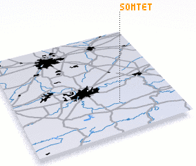 Places with similar names to Somtet, Belgium ::
Disclaimer :: Information on this page comes without warranty of any kind |
||
|
Where is Somtet? Elevation and coordinates ::
Latitude (lat): 50°18'0"N Longitude (lon): 4°39'0"E
Elevation (approx.): 251m (map arrows pan, magnifying glasses zoom) |
||
|
Visiting Somtet? Hotel/Accommodation ::
Book a hotel in Somtet Travel Guide ::
Buy a travel guide for Belgium rental cars ::
car rental offers GPS waypoint ::
download a GPX waypoint (PoI) of Somtet for your GPS receiver
|
||