|
search place name
|
||
Soulme (Namur, Belgium)Soulme is a town in the Namur region of Belgium. An overview map of the region around Soulme is displayed below.
regional and 3d topo map of Soulme, Belgium ::

Soulme airports ::
The nearest airport is CRL - Charleroi Brussels South, located 36.6 km north west of Soulme.
Other airports nearby include LGG - Liege (71.4 km north east), BRU - Brussels Natl (Melsbroek) (81.8 km north), RHE - Reims Champagne (108.9 km south west), MST - Maastricht (109.4 km north east), Nearby towns ::
Vodelée (1.9km south) //
Surice (2.4km west) //
Gochenée (2.4km east) //
Romedenne (3.0km south west) //
Omezée (3.0km north west) //
Trou des Gattes (3.9km south) //
Les Flachis (4.4km north east) //
Gimnée (5.7km south) //
Morville (5.7km north) //
Doische (5.7km south) //
Foisches (6.0km south east) //
Wez de Chine (4.7km west) //
Vaucelles (7.5km south) //
Lotenne (5.1km west) //
Agimont (5.1km east) //
Anthée (7.5km north) //
Rosée (6.6km north west) //
Miavoye (6.6km north east) //
Nowes (6.6km north west) //
Les Trois Fontaines (6.6km south east) //
Romerée (6.6km south west) //
Bosquet (6.6km south west) //
Niverlée (7.8km south) //
Flavion (7.8km north) //
Mon Idée (6.0km south east) //
Les Journeux (6.0km north east) //
Serville (7.8km north) //
Ostemerée (7.8km north) //
Ham-sur-Meuse (8.2km south east) //
[all distances 'as the bird flies' and approximate] 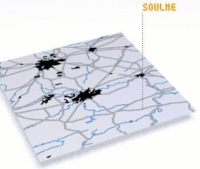 Places with similar names to Soulme, Belgium ::
Disclaimer :: Information on this page comes without warranty of any kind |
||
|
Where is Soulme? Elevation and coordinates ::
Latitude (lat): 50°11'0"N Longitude (lon): 4°44'0"E
Elevation (approx.): 175m (map arrows pan, magnifying glasses zoom) |
||
|
Visiting Soulme? Hotel/Accommodation ::
Book a hotel in Soulme Travel Guide ::
Buy a travel guide for Belgium rental cars ::
car rental offers GPS waypoint ::
download a GPX waypoint (PoI) of Soulme for your GPS receiver
|
||