|
search place name
|
||
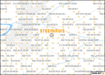
Steenkruis (Antwerpen, Belgium)Steenkruis is a town in the Antwerpen region of Belgium. An overview map of the region around Steenkruis is displayed below.
regional and 3d topo map of Steenkruis, Belgium ::
Steenkruis airports ::
The nearest airport is ANR - Antwerp Deurne, located 5.2 km west of Steenkruis.
Other airports nearby include WOE - Woensdrecht (30.8 km north west), BRU - Brussels Natl (Melsbroek) (33.4 km south), EIN - Eindhoven (64.9 km north east), CRL - Charleroi Brussels South (82.6 km south), Nearby towns ::
Verbrandhof (0.0km north) //
De Pieting (0.0km north) //
Wommelgem (1.2km west) //
De Stommen (1.2km west) //
Keer (1.9km north) //
Ranst (1.2km east) //
Schavijk (1.2km east) //
Groenenbroek (1.9km south) //
Bemdkant (2.2km north west) //
Kapelleveld (2.2km north west) //
Vremde (2.2km south west) //
Eenhoorn (2.2km north east) //
Millegem (2.2km south east) //
Schapenvondert (2.2km south east) //
Wijnegem (3.7km north) //
Moeffenhoeven (2.3km west) //
Eggerseel (3.7km south) //
Laar (2.3km east) //
Wervehoeve (3.9km north) //
Hel (3.9km south) //
Immerseel (3.0km north west) //
Guddegem (3.0km north west) //
Toeffelhoek (3.0km south west) //
Boechout (4.4km south west) //
Schilde (4.4km north east) //
Hagenbroek (4.4km south east) //
Borsbeek (3.5km west) //
Laar (3.5km west) //
Boterlaar (3.5km west) //
[all distances 'as the bird flies' and approximate] 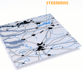 Places with similar names to Steenkruis, Belgium ::
Disclaimer :: Information on this page comes without warranty of any kind |
||
|
Where is Steenkruis? Elevation and coordinates ::
Latitude (lat): 51°12'0"N Longitude (lon): 4°32'0"E
Elevation (approx.): 10m (map arrows pan, magnifying glasses zoom) |
||
|
Visiting Steenkruis? Hotel/Accommodation ::
Book a hotel in Steenkruis Travel Guide ::
Buy a travel guide for Belgium rental cars ::
car rental offers GPS waypoint ::
download a GPX waypoint (PoI) of Steenkruis for your GPS receiver
|
||