|
search place name
|
||
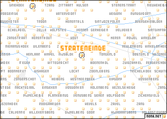
Strateneinde (Antwerpen, Belgium)Strateneinde is a town in the Antwerpen region of Belgium. An overview map of the region around Strateneinde is displayed below.
regional and 3d topo map of Strateneinde, Belgium ::
Strateneinde airports ::
The nearest airport is ANR - Antwerp Deurne, located 28.4 km west of Strateneinde.
Other airports nearby include BRU - Brussels Natl (Melsbroek) (35.1 km south west), WOE - Woensdrecht (51.2 km north west), EIN - Eindhoven (52.1 km north east), LGG - Liege (67.7 km south east), Nearby towns ::
Haart (0.0km north) //
Voortkapel (0.0km north) //
Hulseinde (1.9km north) //
Damseinde (1.2km east) //
Broekhoven (1.2km west) //
De Hand (1.9km south) //
Lankom (2.2km north west) //
Oosterwijk (2.2km north east) //
Zandhoeven (2.2km north west) //
Gelendel (2.2km south east) //
Vijfhuizen (2.2km south east) //
Wittegracht Goorheide (2.2km south west) //
Mijerij (2.2km south east) //
Olen (3.7km north) //
Berteneinde (2.3km west) //
Nijsblok (2.3km west) //
Zandkapel (3.0km north west) //
Groenstraat (3.0km north west) //
Ill (3.0km north east) //
Oevel (3.0km north east) //
Schaatsbergen (3.9km north) //
Hezewijk (3.9km north) //
Plassendonk (3.9km north) //
Schravenhage (3.9km north) //
Noorderwijk (3.9km north) //
Wout (3.9km north) //
Boerenhol (3.0km south east) //
Locht (3.9km south) //
Heultje (3.9km south) //
[all distances 'as the bird flies' and approximate] 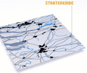 Places with similar names to Strateneinde, Belgium ::
// Strateneinde (BE)
// Strateneinde (BE)
Disclaimer :: Information on this page comes without warranty of any kind |
||
|
Where is Strateneinde? Elevation and coordinates ::
Latitude (lat): 51°7'0"N Longitude (lon): 4°51'0"E
Elevation (approx.): 11m (map arrows pan, magnifying glasses zoom) |
||
|
Visiting Strateneinde? Hotel/Accommodation ::
Book a hotel in Strateneinde Travel Guide ::
Buy a travel guide for Belgium rental cars ::
car rental offers GPS waypoint ::
download a GPX waypoint (PoI) of Strateneinde for your GPS receiver
|
||