|
search place name
|
||
Vogenée (Namur, Belgium)Vogenée is a town in the Namur region of Belgium. An overview map of the region around Vogenée is displayed below.
regional and 3d topo map of Vogenée, Belgium ::

Vogenée airports ::
The nearest airport is CRL - Charleroi Brussels South, located 25.1 km north of Vogenée.
Other airports nearby include BRU - Brussels Natl (Melsbroek) (74.4 km north), LGG - Liege (83.7 km north east), LIL - Lille Lesquin (103.4 km west), ANR - Antwerp Deurne (106.4 km north), Nearby towns ::
Beloeil (0.0km north) //
Daussois (1.9km south) //
Chastrès (1.9km north) //
Bierlée (2.2km south west) //
Fairoul (2.2km north east) //
Le Jardinet (2.2km north west) //
Les Quairelles (2.2km north west) //
Pisselotte (2.4km west) //
Gomezée (2.4km east) //
Battefer (2.4km west) //
Yves-Gomezée (2.4km east) //
Baileu (3.0km south west) //
Les Violettes (3.0km south west) //
Marencheneux (3.9km south) //
Le Fays (3.9km south) //
Gerlimpont (3.0km north west) //
Walcourt (3.0km north west) //
Pont du Diable (3.9km north) //
Tombois (3.9km north) //
Pry (3.9km north) //
Falemprise (4.4km south west) //
Le Coumagne (4.4km south east) //
Laneffe (4.4km north east) //
Par de là lʼEau (4.4km north east) //
Valentinoise (3.6km west) //
Silenrieux (3.6km west) //
La Botte (3.6km east) //
Nazareth (4.0km south west) //
Jamiolle (4.0km south east) //
[all distances 'as the bird flies' and approximate] 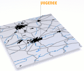 Places with similar names to Vogenée, Belgium ::
Disclaimer :: Information on this page comes without warranty of any kind |
||
|
Where is Vogenée? Elevation and coordinates ::
Latitude (lat): 50°14'0"N Longitude (lon): 4°27'0"E
Elevation (approx.): 250m (map arrows pan, magnifying glasses zoom) |
||
|
Visiting Vogenée? Hotel/Accommodation ::
Book a hotel in Vogenée Travel Guide ::
Buy a travel guide for Belgium rental cars ::
car rental offers GPS waypoint ::
download a GPX waypoint (PoI) of Vogenée for your GPS receiver
|
||