|
search place name
|
||
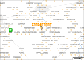
Zandstraat (Antwerpen, Belgium)Zandstraat is a town in the Antwerpen region of Belgium. An overview map of the region around Zandstraat is displayed below.
regional and 3d topo map of Zandstraat, Belgium ::
Zandstraat airports ::
The nearest airport is WOE - Woensdrecht, located 8.7 km west of Zandstraat.
Other airports nearby include ANR - Antwerp Deurne (29.0 km south), RTM - Rotterdam (56.4 km north), BRU - Brussels Natl (Melsbroek) (61.0 km south), EIN - Eindhoven (63.1 km east), Nearby towns ::
Den Heuvel (0.0km north) //
Schanker (1.2km east) //
Essen (1.9km north) //
De Donk (1.2km west) //
Wildert (1.9km south) //
Steenpaal (2.2km north east) //
Nispen (3.7km north) //
Bredestraat (2.3km east) //
Schriek (2.3km east) //
Moerkant (2.3km west) //
Steenpaal (3.9km north) //
Zwanenberg (3.9km south) //
Bergsebaan (3.9km north) //
Horendonk (3.0km north east) //
Nispense Achterhoek (4.4km north east) //
Marijnevennen (4.4km south east) //
Borteldonk (5.6km north) //
Kleine Horendonk (3.5km east) //
Kretenberg (3.5km west) //
Venitiaanseheide (3.5km east) //
Peerdenhoek (3.5km west) //
Dorp (5.6km south) //
Noordeind (5.7km south) //
Achterbroek (5.7km south) //
Handelaar (5.7km south) //
Everland (5.7km north) //
Kalmthoutse Hoek (3.9km south west) //
Vissenheuvel (3.9km south east) //
Nieuwmoer (3.9km south east) //
[all distances 'as the bird flies' and approximate]  Places with similar names to Zandstraat, Belgium ::
Disclaimer :: Information on this page comes without warranty of any kind |
||
|
Where is Zandstraat? Elevation and coordinates ::
Latitude (lat): 51°27'0"N Longitude (lon): 4°28'0"E
Elevation (approx.): 14m (map arrows pan, magnifying glasses zoom) |
||
|
Visiting Zandstraat? Hotel/Accommodation ::
Book a hotel in Zandstraat Travel Guide ::
Buy a travel guide for Belgium rental cars ::
car rental offers GPS waypoint ::
download a GPX waypoint (PoI) of Zandstraat for your GPS receiver
|
||