|
search place name
|
||
Zeverdonk (Antwerpen, Belgium)Zeverdonk is a town in the Antwerpen region of Belgium. An overview map of the region around Zeverdonk is displayed below.
regional and 3d topo map of Zeverdonk, Belgium ::

Zeverdonk airports ::
The nearest airport is EIN - Eindhoven, located 34.0 km north east of Zeverdonk.
Other airports nearby include ANR - Antwerp Deurne (36.3 km west), WOE - Woensdrecht (45.5 km west), BRU - Brussels Natl (Melsbroek) (55.0 km south west), MST - Maastricht (71.9 km south east), Nearby towns ::
Gene Zeverdonk (1.9km south) //
Papenbrugge (1.2km west) //
Veedijk (1.2km west) //
Schorvorst (1.2km east) //
Turnhout (1.9km north) //
Leiseinde (2.2km south west) //
Broekzijde (2.2km north east) //
Lokeren (2.2km north west) //
Kruishuis (2.2km north west) //
Winkel (3.7km south) //
Kleinen Winkel (3.7km south) //
Hoog-Darisdonk (2.3km east) //
Breem (2.3km west) //
Kruisberg (2.3km west) //
Klein Rees (3.9km south) //
Balderij (3.9km south) //
Groot Rees (3.0km south east) //
De Bleuken (3.0km south west) //
Oud-Turnhout (3.0km north east) //
Heizijde (3.9km north) //
Oosthoven (3.9km north) //
Kraanschot (4.4km south west) //
Groot Kluis (4.4km south east) //
Stokt (4.4km north west) //
Nazaret (4.4km north west) //
Kasterlee (5.6km south) //
Meirgoorhoeve (5.6km north) //
Hogen Rielen (5.7km south) //
Lagen Rielen (5.7km south) //
[all distances 'as the bird flies' and approximate] 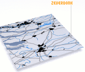 Places with similar names to Zeverdonk, Belgium ::
Disclaimer :: Information on this page comes without warranty of any kind |
||
|
Where is Zeverdonk? Elevation and coordinates ::
Latitude (lat): 51°18'0"N Longitude (lon): 4°57'0"E
Elevation (approx.): 20m (map arrows pan, magnifying glasses zoom) |
||
|
Visiting Zeverdonk? Hotel/Accommodation ::
Book a hotel in Zeverdonk Travel Guide ::
Buy a travel guide for Belgium rental cars ::
car rental offers GPS waypoint ::
download a GPX waypoint (PoI) of Zeverdonk for your GPS receiver
|
||