|
search place name
|
||
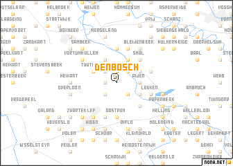
Den Bosch (Noord-Brabant, Netherlands)Den Bosch is a town in the Noord-Brabant region of Netherlands. An overview map of the region around Den Bosch is displayed below.
regional and 3d topo map of Den Bosch, Netherlands ::
Den Bosch airports ::
The nearest airport is EIN - Eindhoven, located 47.0 km west of Den Bosch.
Other airports nearby include MGL - Moenchengladbach Monchengladbach (51.9 km south east), DUS - Duesseldorf Dusseldorf (61.6 km south east), ESS - Essen Mulheim (67.0 km east), GKE - Geilenkirchen (69.3 km south), Nearby towns ::
Schafferden (1.2km west) //
Vierlingsbeek (1.9km north) //
Maashees (2.2km south east) //
Loobeek (2.2km south west) //
Holthees (2.2km south west) //
Smakt (2.2km south west) //
Bergen (2.2km north east) //
Groeningen (2.2km north west) //
Aijen (2.3km east) //
Kamp (3.0km south east) //
Nieuw-Bergen (3.0km north east) //
Heukelom (3.9km north) //
Tuuthees (3.0km north west) //
Klein-Vortum (3.9km north) //
Geysteren (4.4km south east) //
Smal (4.4km north east) //
Afferden (5.6km north) //
Oostrum (5.6km south) //
Gening (5.7km north) //
Rimpeld (5.7km north) //
Leuken (3.9km south east) //
Boshuizen (5.7km south) //
Bergsche Heide (3.9km north east) //
Bleijenbeek (6.0km north) //
Venray (6.0km south west) //
Vortum-Mullem (5.1km north west) //
Heikant (4.6km west) //
Oirlo (7.5km south) //
Zandhoek (7.5km south) //
[all distances 'as the bird flies' and approximate]  Places with similar names to Den Bosch, Netherlands ::
Disclaimer :: Information on this page comes without warranty of any kind |
||
|
Where is Den Bosch? Elevation and coordinates ::
Latitude (lat): 51°35'0"N Longitude (lon): 6°1'0"E
Elevation (approx.): 15m (map arrows pan, magnifying glasses zoom) |
||
|
Visiting Den Bosch? Hotel/Accommodation ::
Book a hotel in Den Bosch Travel Guide ::
Buy a travel guide for Netherlands rental cars ::
car rental offers GPS waypoint ::
download a GPX waypoint (PoI) of Den Bosch for your GPS receiver
|
||