|
search place name
|
||
Eernewoude (Friesland, Netherlands)Eernewoude is a town in the Friesland region of Netherlands. An overview map of the region around Eernewoude is displayed below.
regional and 3d topo map of Eernewoude, Netherlands ::

Eernewoude airports ::
The nearest airport is LWR - Leeuwarden, located 15.7 km north west of Eernewoude.
Other airports nearby include GRQ - Groningen Eelde (43.3 km east), BMK - Borkum (72.9 km north east), DHR - De Kooy (80.8 km west), EME - Emden (91.0 km east), Nearby towns ::
De Veenhoop (3.9km south) //
Wartena (2.9km north west) //
Siegerswoude (2.9km north east) //
Garijp (4.3km north east) //
Uiteinde (3.3km east) //
Suawoude (5.6km north) //
De Gaasten (3.8km south east) //
Kloosterburen (3.8km north east) //
Midsburen (3.8km north west) //
Warniahuizen (7.4km south) //
Opperburen (4.4km east) //
Oudega (4.4km east) //
Poppenhuizen (7.5km south) //
Tietjerk (7.5km north) //
Iniaheide (4.8km north east) //
Goëngahuizen (6.5km south west) //
Warstiens (5.8km north west) //
Kleinegeest (7.7km north) //
Suameer (7.1km north east) //
Sorremorre (8.6km south west) //
Nij Beets (8.6km south east) //
Bergum (8.6km north east) //
[all distances 'as the bird flies' and approximate] 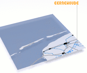 Places with similar names to Eernewoude, Netherlands :: Disclaimer :: Information on this page comes without warranty of any kind |
||
|
Where is Eernewoude? Elevation and coordinates ::
Latitude (lat): 53°8'0"N Longitude (lon): 5°56'0"E
Elevation (approx.): -2m (map arrows pan, magnifying glasses zoom) |
||
|
Visiting Eernewoude? Hotel/Accommodation ::
Book a hotel in Eernewoude Travel Guide ::
Buy a travel guide for Netherlands rental cars ::
car rental offers GPS waypoint ::
download a GPX waypoint (PoI) of Eernewoude for your GPS receiver
|
||