|
search place name
|
||
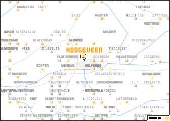
Hoogeveen (Drenthe, Netherlands)Hoogeveen is a town in the Drenthe region of Netherlands. An overview map of the region around Hoogeveen is displayed below.
regional and 3d topo map of Hoogeveen, Netherlands ::
Hoogeveen airports ::
The nearest airport is GRQ - Groningen Eelde, located 43.5 km north of Hoogeveen.
Other airports nearby include ENS - Enschede Twenthe (58.0 km south east), LWR - Leeuwarden (73.4 km north west), EME - Emden (88.6 km north east), BMK - Borkum (97.1 km north), Nearby towns ::
Stadterij (1.1km east) //
Veenesluis (2.2km south west) //
Schoon Velde (2.2km south west) //
Wolfsbos (2.2km south east) //
Stuifzand (2.2km north east) //
Fluitenberg (2.2km west) //
Achterom (2.2km east) //
De Weide (2.9km south west) //
Krakeel (2.9km south east) //
Krakeel (2.9km south east) //
De Marke (3.9km north) //
Zwartschaap (3.9km north) //
Pesse (4.3km north west) //
Bultinge (4.3km north west) //
Alteveer (5.6km south) //
Kalenberg (3.4km west) //
Noordscheschut (3.8km south east) //
Siberie (3.8km north east) //
Hollandscheveld (5.0km south east) //
Ten Arlo (5.0km south west) //
Nuil (6.0km north) //
Eursinge (6.0km north) //
Kerkenveld (7.5km south) //
Kerkenbosch (7.5km south) //
Gijsselte (4.9km west) //
Tiendeveen (4.9km east) //
Steenbergen (6.5km south west) //
Zuideropgaande (6.5km south east) //
Zuidwolde (6.5km south west) //
[all distances 'as the bird flies' and approximate] 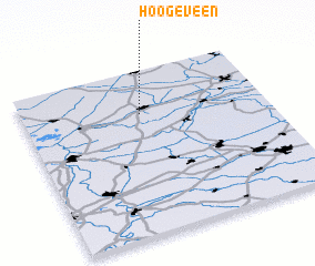
Disclaimer :: Information on this page comes without warranty of any kind |
||
|
Where is Hoogeveen? Elevation and coordinates ::
Latitude (lat): 52°44'0"N Longitude (lon): 6°29'0"E
Elevation (approx.): 11m (map arrows pan, magnifying glasses zoom) |
||
|
Visiting Hoogeveen? Hotel/Accommodation ::
Book a hotel in Hoogeveen Travel Guide ::
Buy a travel guide for Netherlands rental cars ::
car rental offers GPS waypoint ::
download a GPX waypoint (PoI) of Hoogeveen for your GPS receiver
|
||