|
search place name
|
||
Jisp (Noord-Holland, Netherlands)Jisp is a town in the Noord-Holland region of Netherlands. An overview map of the region around Jisp is displayed below.
regional and 3d topo map of Jisp, Netherlands ::

Jisp airports ::
The nearest airport is AMS - Amsterdam Schiphol, located 23.9 km south of Jisp.
Other airports nearby include DHR - De Kooy (45.5 km north), LID - Valkenburg (48.9 km south west), UTC - Soesterberg (52.2 km south east), RTM - Rotterdam (68.4 km south west), Nearby towns ::
Spijkerboor (2.2km north west) //
Wormer (2.9km south west) //
Haaldersbroek (3.9km south) //
Oost-Graftdijk (4.3km north west) //
De Rijp (5.6km north) //
Oost-Knollendam (3.4km west) //
Klaterbuurt (5.7km north) //
Noordeinde (5.7km north) //
Graft (5.7km north) //
Het Kalf (5.7km south) //
West-Graftdijk (5.0km north west) //
De Haal (6.0km south) //
Zaandijk (5.0km south west) //
Wormerveer (5.0km south west) //
Grootschermer (7.4km north) //
West-Knollendam (4.5km west) //
Neck (4.5km east) //
Markenbinnen (4.9km west) //
Zaanstad (7.5km south) //
De Heul (7.5km south) //
Oostzaan (7.5km south) //
Zaandam (7.5km south) //
Westbeemster (6.5km north east) //
Koog aan de Zaan (6.5km south west) //
Driehuizen (7.7km north) //
De Woude (5.8km north west) //
Middenbeemster (5.8km north east) //
Zuidschermer (8.7km north west) //
Den Ilp (8.7km south east) //
[all distances 'as the bird flies' and approximate] 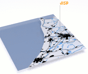 Places with similar names to Jisp, Netherlands ::
Disclaimer :: Information on this page comes without warranty of any kind |
||
|
Where is Jisp? Elevation and coordinates ::
Latitude (lat): 52°31'0"N Longitude (lon): 4°51'0"E
(map arrows pan, magnifying glasses zoom) |
||
|
Visiting Jisp? Hotel/Accommodation ::
Book a hotel in Jisp Travel Guide ::
Buy a travel guide for Netherlands rental cars ::
car rental offers GPS waypoint ::
download a GPX waypoint (PoI) of Jisp for your GPS receiver
|
||