|
search place name
|
||
Kouwenberg (Noord-Brabant, Netherlands)Kouwenberg is a town in the Noord-Brabant region of Netherlands. An overview map of the region around Kouwenberg is displayed below.
regional and 3d topo map of Kouwenberg, Netherlands ::

Kouwenberg airports ::
The nearest airport is EIN - Eindhoven, located 26.2 km south east of Kouwenberg.
Other airports nearby include WOE - Woensdrecht (54.1 km west), RTM - Rotterdam (59.7 km north west), UTC - Soesterberg (60.2 km north), ANR - Antwerp Deurne (63.0 km south west), Nearby towns ::
Vijfhuizen (1.2km east) //
Quirijnstok (1.2km east) //
Houtsestraat (1.2km east) //
Klokkenberg (1.9km north) //
Lijnsheike (1.9km south) //
Heikant (1.9km south) //
Hasselt (1.9km south) //
Moleneind (1.9km north) //
Stokhasselt (1.9km south) //
Molenstraat (2.2km north east) //
Rugdijk (2.2km south east) //
Hazennest (2.2km south east) //
Loon op Zand (3.7km north) //
Goirke (3.7km south) //
Groeseind (3.7km south) //
Veldhoven (3.7km south) //
Kuil (2.3km east) //
Noordhoek (3.9km south) //
Den Hoek (3.9km north) //
Kraanven (3.0km north west) //
Het Wandelbos (3.0km south west) //
Quirijnstok (3.9km south) //
Loven (3.9km south) //
Schoorstraat (3.0km north east) //
Duiksehoef (4.4km north west) //
Heikant (4.4km north west) //
ʼt Zand (4.4km south west) //
De Reit (4.4km south west) //
Hoogeind (4.4km south east) //
[all distances 'as the bird flies' and approximate] 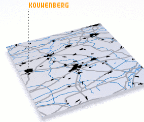 Places with similar names to Kouwenberg, Netherlands ::
Disclaimer :: Information on this page comes without warranty of any kind |
||
|
Where is Kouwenberg? Elevation and coordinates ::
Latitude (lat): 51°36'0"N Longitude (lon): 5°5'0"E
Elevation (approx.): 14m (map arrows pan, magnifying glasses zoom) |
||
|
Visiting Kouwenberg? Hotel/Accommodation ::
Book a hotel in Kouwenberg Travel Guide ::
Buy a travel guide for Netherlands rental cars ::
car rental offers GPS waypoint ::
download a GPX waypoint (PoI) of Kouwenberg for your GPS receiver
|
||