|
search place name
|
||
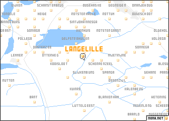
Langelille (Friesland, Netherlands)Langelille is a town in the Friesland region of Netherlands. An overview map of the region around Langelille is displayed below.
regional and 3d topo map of Langelille, Netherlands ::
Langelille airports ::
The nearest airport is LWR - Leeuwarden, located 42.6 km north of Langelille.
Other airports nearby include GRQ - Groningen Eelde (57.5 km north east), DHR - De Kooy (72.4 km west), UTC - Soesterberg (89.4 km south west), ENS - Enschede Twenthe (94.8 km south east), Nearby towns ::
Gracht (1.1km east) //
Zevenbuurt (1.9km north) //
Bandsloot (2.2km west) //
Munnekeburen (2.2km east) //
Slijkenburg (3.7km south) //
Delfstrahuizen (3.9km north) //
Echtenerbrug (2.9km north west) //
Scherpenzeel (2.9km south east) //
Schoterzijl (4.3km south west) //
Vierhuis (5.6km north) //
Commissiepolle (3.8km north west) //
Kooisloot (3.8km south west) //
Echten (3.8km north west) //
Bantega (3.8km south west) //
Spanga (5.0km south east) //
Polle (7.4km north) //
Sintjohannesga (7.4km north) //
Otterweg (4.5km west) //
Middenvaart (4.5km west) //
Nijetrijne (4.5km east) //
Rohel (7.5km north) //
Kuinre (7.5km south) //
Rotstergaast (6.5km north east) //
Oldeouwer (8.1km north west) //
Ossenzijl (7.1km south east) //
[all distances 'as the bird flies' and approximate]  Places with similar names to Langelille, Netherlands ::
// Lungi-Lol (SL)
Disclaimer :: Information on this page comes without warranty of any kind |
||
|
Where is Langelille? Elevation and coordinates ::
Latitude (lat): 52°51'0"N Longitude (lon): 5°51'0"E
Elevation (approx.): -2m (map arrows pan, magnifying glasses zoom) |
||
|
Visiting Langelille? Hotel/Accommodation ::
Book a hotel in Langelille Travel Guide ::
Buy a travel guide for Netherlands rental cars ::
car rental offers GPS waypoint ::
download a GPX waypoint (PoI) of Langelille for your GPS receiver
|
||