|
search place name
|
||
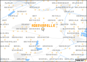
Moerkapelle (Zuid-Holland, Netherlands)Moerkapelle is a town in the Zuid-Holland region of Netherlands. An overview map of the region around Moerkapelle is displayed below.
regional and 3d topo map of Moerkapelle, Netherlands ::
Moerkapelle airports ::
The nearest airport is RTM - Rotterdam, located 14.4 km south west of Moerkapelle.
Other airports nearby include LID - Valkenburg (17.2 km north west), AMS - Amsterdam Schiphol (31.3 km north east), UTC - Soesterberg (48.3 km east), WOE - Woensdrecht (68.9 km south), Nearby towns ::
Hollevoeterbrug (2.2km south west) //
Zevenhuizen (3.7km south) //
De Kruisweg (2.3km west) //
Hogeveen (3.7km north) //
Benthuizen (4.4km north west) //
Voorweg (4.4km north east) //
Hazerswoude-Dorp (5.6km north) //
Westeinde (5.7km north) //
Noordeinde (3.9km north east) //
Wijk (3.9km north east) //
Snijdel (3.9km north east) //
Bleiswijk (5.0km south west) //
De Roemer (5.0km north east) //
Bent (6.0km north) //
Den Hoorn (4.6km west) //
Waddinxveen (4.6km east) //
Zegwaart (4.9km west) //
Groeneweg (7.5km south) //
Oosthoekeind (6.5km south west) //
Gelderswoude (6.5km north west) //
Rietveld (6.5km north east) //
Oud Verlaat (7.8km south) //
Loete (5.9km north east) //
Weipoort (8.7km north west) //
[all distances 'as the bird flies' and approximate]  Places with similar names to Moerkapelle, Netherlands ::
// Mariäkappel (DE)
// Markopolʼ (UA)
Disclaimer :: Information on this page comes without warranty of any kind |
||
|
Where is Moerkapelle? Elevation and coordinates ::
Latitude (lat): 52°3'0"N Longitude (lon): 4°35'0"E
Elevation (approx.): -5m (map arrows pan, magnifying glasses zoom) |
||
|
Visiting Moerkapelle? Hotel/Accommodation ::
Book a hotel in Moerkapelle Travel Guide ::
Buy a travel guide for Netherlands rental cars ::
car rental offers GPS waypoint ::
download a GPX waypoint (PoI) of Moerkapelle for your GPS receiver
|
||