|
search place name
|
||
Muiderberg (Noord-Holland, Netherlands)Muiderberg is a town in the Noord-Holland region of Netherlands. An overview map of the region around Muiderberg is displayed below.
regional and 3d topo map of Muiderberg, Netherlands ::

Muiderberg airports ::
The nearest airport is AMS - Amsterdam Schiphol, located 24.2 km west of Muiderberg.
Other airports nearby include UTC - Soesterberg (25.4 km south east), LID - Valkenburg (51.2 km west), RTM - Rotterdam (62.6 km south west), DHR - De Kooy (69.5 km north), Nearby towns ::
Naardermeer (2.2km south west) //
Hakkelaarsbrug (2.2km south west) //
Hanendorp (2.9km south west) //
Naarden (4.3km south east) //
Uitermeer (4.3km south west) //
Almere-Stad (4.3km north east) //
Hollandsch Ankeveen (5.6km south) //
Muiden (3.4km west) //
Het Spiegel (6.0km south) //
De Horn (5.0km south west) //
Hilversumse Meent (7.5km south) //
Almere-Haven (4.9km east) //
Valkeveen (4.9km east) //
Ankeveen (7.5km south) //
Hinderdam (6.5km south west) //
Bredius Kwartier (6.5km south east) //
Westereng (8.2km south east) //
Nederhorst den Berg (8.7km south west) //
[all distances 'as the bird flies' and approximate] 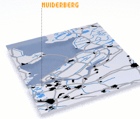 Places with similar names to Muiderberg, Netherlands ::
// Mitterberg (AT)
// Mitterberg (AT)
// Mitterberg (AT)
// Mitterberg (AT)
// Mitterberg (AT)
// Mitterberg (AT)
// Mitterberg (AT)
// Möderbrugg (AT)
// Mitterberg (DE)
Disclaimer :: Information on this page comes without warranty of any kind |
||
|
Where is Muiderberg? Elevation and coordinates ::
Latitude (lat): 52°20'0"N Longitude (lon): 5°7'0"E
Elevation (approx.): -32768m (map arrows pan, magnifying glasses zoom) |
||
|
Visiting Muiderberg? Hotel/Accommodation ::
Book a hotel in Muiderberg Travel Guide ::
Buy a travel guide for Netherlands rental cars ::
car rental offers GPS waypoint ::
download a GPX waypoint (PoI) of Muiderberg for your GPS receiver
|
||