|
search place name
|
||
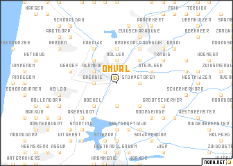
Omval (Noord-Holland, Netherlands)Omval is a town in the Noord-Holland region of Netherlands. An overview map of the region around Omval is displayed below.
regional and 3d topo map of Omval, Netherlands ::
Omval airports ::
The nearest airport is DHR - De Kooy, located 34.1 km north of Omval.
Other airports nearby include AMS - Amsterdam Schiphol (34.3 km south), LID - Valkenburg (56.0 km south west), UTC - Soesterberg (64.0 km south east), RTM - Rotterdam (77.1 km south), Nearby towns ::
Oudorp (1.9km north) //
Nollen (3.7km north) //
Zuideinde (3.7km north) //
Overdie (2.3km west) //
Stompetoren (2.3km east) //
Zuidschermer (3.7km south) //
Alkmaar (2.9km north west) //
Huiswaard (4.3km north west) //
Butterhuizen (4.3km north east) //
Boekel (4.3km south west) //
Driehuizen (4.3km south east) //
Sint Pancras (5.6km north) //
Oterleek (3.9km north east) //
Koedijk (6.0km north) //
Broek op Langedijk (6.0km north) //
Broekhorn (6.0km north) //
De Woude (7.4km south) //
De Hoef (4.9km west) //
West-Graftdijk (7.5km south) //
Noordeinde (6.5km south east) //
Graft (6.5km south east) //
Akersloot (6.5km south west) //
Zuid-Scharwoude (7.7km north) //
ʼt Kruis (5.8km north east) //
Kabel (5.8km north east) //
Grootschermer (5.8km south east) //
Oost-Graftdijk (7.7km south) //
Heerhugowaard (7.2km north east) //
De Rijp (7.2km south east) //
[all distances 'as the bird flies' and approximate] 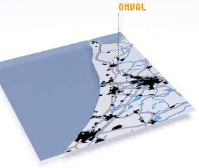
Disclaimer :: Information on this page comes without warranty of any kind |
||
|
Where is Omval? Elevation and coordinates ::
Latitude (lat): 52°37'0"N Longitude (lon): 4°47'0"E
Elevation (approx.): -3m (map arrows pan, magnifying glasses zoom) |
||
|
Visiting Omval? Hotel/Accommodation ::
Book a hotel in Omval Travel Guide ::
Buy a travel guide for Netherlands rental cars ::
car rental offers GPS waypoint ::
download a GPX waypoint (PoI) of Omval for your GPS receiver
|
||