|
search place name
|
||
Roordahuizum (Friesland, Netherlands)Roordahuizum is a town in the Friesland region of Netherlands. An overview map of the region around Roordahuizum is displayed below.
regional and 3d topo map of Roordahuizum, Netherlands ::

Roordahuizum airports ::
The nearest airport is LWR - Leeuwarden, located 12.7 km north of Roordahuizum.
Other airports nearby include GRQ - Groningen Eelde (52.2 km east), DHR - De Kooy (71.7 km west), BMK - Borkum (80.6 km north east), EME - Emden (100.0 km east), Nearby towns ::
Idaard (0.0km north) //
Friens (1.9km south) //
Tjaard (2.2km north east) //
Baardburen (2.2km north west) //
Hornsterburen (2.2km south west) //
Wijtgaard (3.7km north) //
Irnsum (3.7km south) //
Aegum (2.9km north east) //
Swichum (3.9km north) //
Wirdum (3.9km north) //
Grouw (2.9km south east) //
Zuiderend (3.9km south) //
Kerkeburen (3.9km south) //
Warga (4.3km north east) //
Flansum (4.3km south west) //
Domwier (3.8km north east) //
De Hem (5.7km north) //
Rauwerd (3.8km south west) //
Abbengawier (5.7km south) //
Oude Schouw (5.7km south) //
Naarderburen (5.0km north east) //
Weidum (5.0km north west) //
Zuiderburen (6.0km north) //
Poppingawier (5.0km south west) //
Engwerd (5.0km south west) //
Goutum (7.4km north) //
Oosterwierum (4.4km west) //
Nylan (7.5km north) //
Aldlan (7.5km north) //
[all distances 'as the bird flies' and approximate] 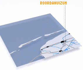 Places with similar names to Roordahuizum, Netherlands :: Disclaimer :: Information on this page comes without warranty of any kind |
||
|
Where is Roordahuizum? Elevation and coordinates ::
Latitude (lat): 53°7'0"N Longitude (lon): 5°48'0"E
Elevation (approx.): -2m (map arrows pan, magnifying glasses zoom) |
||
|
Visiting Roordahuizum? Hotel/Accommodation ::
Book a hotel in Roordahuizum Travel Guide ::
Buy a travel guide for Netherlands rental cars ::
car rental offers GPS waypoint ::
download a GPX waypoint (PoI) of Roordahuizum for your GPS receiver
|
||