|
search place name
|
||
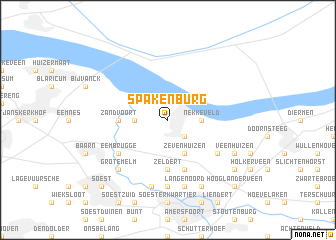
Spakenburg (Utrecht, Netherlands)Spakenburg is a town in the Utrecht region of Netherlands. An overview map of the region around Spakenburg is displayed below.
regional and 3d topo map of Spakenburg, Netherlands ::
Spakenburg airports ::
The nearest airport is UTC - Soesterberg, located 15.0 km south west of Spakenburg.
Other airports nearby include AMS - Amsterdam Schiphol (41.7 km west), LID - Valkenburg (65.5 km west), RTM - Rotterdam (71.5 km south west), DHR - De Kooy (84.8 km north west), Nearby towns ::
Bunschoten (2.2km south east) //
Nekkeveld (2.3km east) //
Eemdijk (2.3km west) //
Zevenhuizen (3.9km south) //
Zeldert (5.6km south) //
Zandvoort (3.4km west) //
Nieuwland (5.7km south) //
Eembrugge (5.0km south west) //
Achterhoek (5.0km south east) //
Bieshaar (7.4km south) //
Hoogland (7.4km south) //
Langenoord (7.5km south) //
Coelhorst (7.5km south) //
Grote Melm (6.5km south west) //
Veenhuizen (5.9km south east) //
Palestina (5.9km south east) //
De Brand (7.8km south) //
Den Ham (7.8km south) //
Buurtsdijk (7.2km south east) //
Hooglanderveen (8.7km south east) //
Soest (8.7km south west) //
[all distances 'as the bird flies' and approximate] 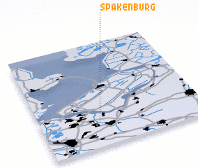 Places with similar names to Spakenburg, Netherlands :: Disclaimer :: Information on this page comes without warranty of any kind |
||
|
Where is Spakenburg? Elevation and coordinates ::
Latitude (lat): 52°15'0"N Longitude (lon): 5°22'0"E
Elevation (approx.): 1m (map arrows pan, magnifying glasses zoom) |
||
|
Visiting Spakenburg? Hotel/Accommodation ::
Book a hotel in Spakenburg Travel Guide ::
Buy a travel guide for Netherlands rental cars ::
car rental offers GPS waypoint ::
download a GPX waypoint (PoI) of Spakenburg for your GPS receiver
|
||