|
search place name
|
||
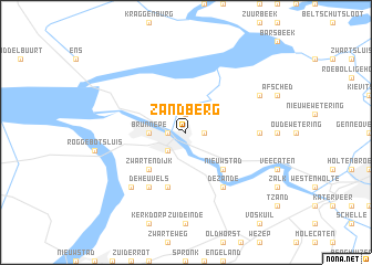
Zandberg (Overijssel, Netherlands)Zandberg is a town in the Overijssel region of Netherlands. An overview map of the region around Zandberg is displayed below.
regional and 3d topo map of Zandberg, Netherlands ::
Zandberg airports ::
The nearest airport is UTC - Soesterberg, located 66.3 km south west of Zandberg.
Other airports nearby include ENS - Enschede Twenthe (72.0 km south east), LWR - Leeuwarden (74.6 km north), GRQ - Groningen Eelde (75.4 km north east), AMS - Amsterdam Schiphol (84.6 km west), Nearby towns ::
IJsselmuiden (1.1km west) //
Grafhorst (1.9km north) //
De Plas (1.9km north) //
Oosterholt (1.1km east) //
Kampen (2.2km south west) //
Flevowijk (2.2km south west) //
Brunnepe (2.3km west) //
Zwartendijk (4.3km south west) //
Kamperveen (4.3km south west) //
Wilsum (4.3km south east) //
Nieuwstad (4.3km south east) //
Hogeweg (5.7km south) //
De Heuvels (6.0km south) //
De Zande (6.0km south) //
Bisschopswetering (4.5km east) //
Kampernieuwstad (6.5km south west) //
Kamperzeedijk (5.8km north east) //
[all distances 'as the bird flies' and approximate] 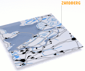 Places with similar names to Zandberg, Netherlands ::
// Sandberg (US)
// Sandberg (DE)
// Sandberg (DE)
// Sandberg (DE)
// Sandberg (DE)
// Sandberg (DE)
// Sandy Brook (US)
// Sand Brook (US)
// Zandberg (NL)
// Zandberg (NL)
Disclaimer :: Information on this page comes without warranty of any kind |
||
|
Where is Zandberg? Elevation and coordinates ::
Latitude (lat): 52°34'0"N Longitude (lon): 5°56'0"E
Elevation (approx.): 1m (map arrows pan, magnifying glasses zoom) |
||
|
Visiting Zandberg? Hotel/Accommodation ::
Book a hotel in Zandberg Travel Guide ::
Buy a travel guide for Netherlands rental cars ::
car rental offers GPS waypoint ::
download a GPX waypoint (PoI) of Zandberg for your GPS receiver
|
||