|
search place name
|
||
Ambélia (Piraiévs, Greece)Ambélia is a town in the Piraiévs region of Greece. An overview map of the region around Ambélia is displayed below.
regional and 3d topo map of Ambélia, Greece ::

Ambélia airports ::
The nearest airport is AGQ - Agrinion, located 25.9 km south west of Ambélia.
Other airports nearby include PVK - Preveza Aktio (62.1 km west), GPA - Patras Araxos (74.0 km south), PYR - Andravida (100.6 km south), IOA - Ioannina (112.4 km north west), Nearby towns ::
Dhrosiniótika (1.9km north) //
Stavrós (1.9km south) //
Avlakiaí (2.3km south west) //
Variaí (2.9km east) //
Káto Áyios Vlásios (2.9km east) //
Pídhima (3.7km north) //
Xilopérama (2.9km west) //
Vaïnárion (4.0km north) //
Kellákia (4.0km south) //
Kelanítis (4.0km south) //
Láta (4.7km south west) //
Karamanaíika (4.7km north east) //
Kipárissos (5.7km south) //
Pakhtírion (4.7km north west) //
Áno Áyios Vlásios (4.7km south east) //
Paliokhória (5.7km north east) //
Ayía Paraskeví (6.3km north east) //
Potamoúla (6.3km south west) //
Prandikón (5.8km west) //
Khoúni (6.1km east) //
Petrotó (6.1km east) //
Tsinaíika (7.6km south) //
Saryiádha (7.0km south west) //
Lákkai (7.0km north east) //
Pendákorfon (6.9km south east) //
Frangóskala (8.0km south) //
Paliokhóri (8.6km south east) //
Mavrommátion (8.0km south west) //
Kastanoúla (9.4km south east) //
[all distances 'as the bird flies' and approximate] 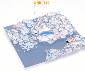 Places with similar names to Ambélia, Greece ::
Disclaimer :: Information on this page comes without warranty of any kind |
||
|
Where is Ambélia? Elevation and coordinates ::
Latitude (lat): 38°49'0"N Longitude (lon): 21°28'0"E
Elevation (approx.): 376m (map arrows pan, magnifying glasses zoom) |
||
|
Visiting Ambélia? Hotel/Accommodation ::
Book a hotel in Ambélia Travel Guide ::
Buy a travel guide for Greece rental cars ::
car rental offers GPS waypoint ::
download a GPX waypoint (PoI) of Ambélia for your GPS receiver
|
||