|
search place name
|
||
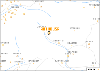
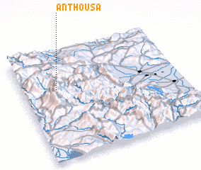
Anthoúsa (Tríkala, Greece)Anthoúsa is a town in the Tríkala region of Greece. An overview map of the region around Anthoúsa is displayed below.
regional and 3d topo map of Anthoúsa, Greece ::
Anthoúsa airports ::
The nearest airport is IOA - Ioannina, located 34.2 km west of Anthoúsa.
Other airports nearby include KSO - Kastoria Aristotelis (87.3 km north), KZI - Kozani Filippos (87.4 km north east), PVK - Preveza Aktio (90.6 km south west), LRA - Larissa Larisa (107.0 km east), Nearby towns ::
Disclaimer :: Information on this page comes without warranty of any kind |
||
|
Where is Anthoúsa? Elevation and coordinates ::
Latitude (lat): 39°39'43"N Longitude (lon): 21°13'6"E
Elevation (approx.): 1107m (map arrows pan, magnifying glasses zoom) |
||
|
Visiting Anthoúsa? Hotel/Accommodation ::
Book a hotel in Anthoúsa Travel Guide ::
Buy a travel guide for Greece rental cars ::
car rental offers GPS waypoint ::
download a GPX waypoint (PoI) of Anthoúsa for your GPS receiver
|
||