|
search place name
|
||
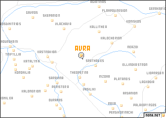
Ávra (Tríkala, Greece)Ávra is a town in the Tríkala region of Greece. An overview map of the region around Ávra is displayed below.
regional and 3d topo map of Ávra, Greece ::
Ávra airports ::
The nearest airport is KZI - Kozani Filippos, located 65.1 km north of Ávra.
Other airports nearby include LRA - Larissa Larisa (66.9 km east), IOA - Ioannina (74.4 km west), KSO - Kastoria Aristotelis (88.7 km north west), VOL - Nea Anghialos Nea Anchialos (109.6 km south east), Nearby towns ::
Spathádes (2.7km south east) //
Theópetra (4.2km south) //
Ágioi Theódoroi (5.7km south) //
Kalampáka (5.4km west) //
Rízoma (6.4km south east) //
Kallithéa (6.8km north east) //
Kalochórion (6.2km north east) //
Kastrákion (6.2km west) //
Sarakína (7.1km south west) //
Vlacháva (7.6km north west) //
Vasilikí (8.1km south) //
Peristéra (8.4km south west) //
Agía Paraskeví (8.6km south west) //
Vitoumás (9.7km south west) //
Skepárion (10.2km north west) //
[all distances 'as the bird flies' and approximate] 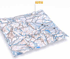 Places with similar names to Ávra, Greece ::
Disclaimer :: Information on this page comes without warranty of any kind |
||
|
Where is Ávra? Elevation and coordinates ::
Latitude (lat): 39°42'40"N Longitude (lon): 21°41'23"E
Elevation (approx.): 249m (map arrows pan, magnifying glasses zoom) |
||
|
Visiting Ávra? Hotel/Accommodation ::
Book a hotel in Ávra Travel Guide ::
Buy a travel guide for Greece rental cars ::
car rental offers GPS waypoint ::
download a GPX waypoint (PoI) of Ávra for your GPS receiver
|
||