|
search place name
|
||
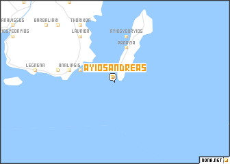
Áyios Andréas (Piraiévs, Greece)Áyios Andréas is a town in the Piraiévs region of Greece. An overview map of the region around Áyios Andréas is displayed below.
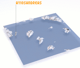
regional and 3d topo map of Áyios Andréas, Greece ::
Áyios Andréas airports ::
The nearest airport is JMK - Mykonos Mikonos, located 112.8 km east of Áyios Andréas.
Other airports nearby include SKU - Skiros (150.1 km north), JSI - Skiathos Alexandros Papadiamantis (177.3 km north), KIT - Kithira (180.6 km south west), JTR - Santorini (185.3 km south east), Nearby towns ::
 Places with similar names to Áyios Andréas, Greece ::
// Áyios Andhréas (GR)
// Áyios Andhréas (GR)
// Áyios Andréas (GR)
// Áyios Andréas (GR)
// Áyios Andréas (GR)
// Áyios Andréas (GR)
// Áyios Andréas (GR)
// Áyios Andréas (GR)
// Áyios Andréas (GR)
// Áyios Andréas (GR)
Disclaimer :: Information on this page comes without warranty of any kind |
||
|
Where is Áyios Andréas? Elevation and coordinates ::
Latitude (lat): 37°39'0"N Longitude (lon): 24°6'0"E
Elevation (approx.): -32768m (map arrows pan, magnifying glasses zoom) |
||
|
Visiting Áyios Andréas? Hotel/Accommodation ::
Book a hotel in Áyios Andréas Travel Guide ::
Buy a travel guide for Greece rental cars ::
car rental offers GPS waypoint ::
download a GPX waypoint (PoI) of Áyios Andréas for your GPS receiver
|
||