|
search place name
|
||
Ferendináta (Piraiévs, Greece)Ferendináta is a town in the Piraiévs region of Greece. An overview map of the region around Ferendináta is displayed below.
regional and 3d topo map of Ferendináta, Greece ::

Ferendináta airports ::
The nearest airport is EFL - Keffallinia Kefallinia, located 23.0 km south of Ferendináta.
Other airports nearby include ZTH - Zakynthos Dionysios Solomos (68.1 km south east), PVK - Preveza Aktio (69.4 km north), AGQ - Agrinion (74.1 km north east), GPA - Patras Araxos (76.0 km east), Nearby towns ::
Raftopouláta (0.0km north) //
Logaráta (1.5km west) //
Andipáta (1.5km west) //
Dhrakopouláta (1.9km south) //
Vallianáta (2.4km south west) //
Markáta (2.4km south west) //
Ayía Evfimía (2.4km south east) //
Marketáta (2.9km west) //
Loukáta (2.9km west) //
Bekatoráta (2.9km west) //
Tarkasáta (3.7km south) //
Dhivaráta (3.4km north west) //
Lekatsáta (3.4km north west) //
Anomeriá (3.4km north west) //
Dhrakáta (3.4km north west) //
Makriótika (3.4km south west) //
Neokhórion (4.7km north east) //
Karyá (5.6km north) //
Patrikáta (5.7km north) //
Komitáta (5.7km north) //
Varí (7.4km north) //
Kothréas (7.6km north) //
Dhefaranáta (7.6km north) //
Vlakháta (7.6km south) //
Livathináta (7.6km south) //
Latavináta (7.6km south) //
Ásos (8.0km north) //
Froúrion (8.6km north west) //
Sámi (9.1km south east) //
[all distances 'as the bird flies' and approximate] 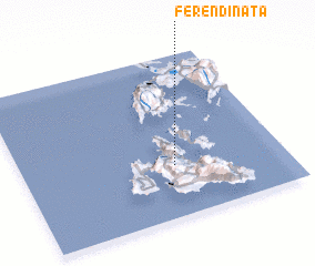 Places with similar names to Ferendináta, Greece ::
Disclaimer :: Information on this page comes without warranty of any kind |
||
|
Where is Ferendináta? Elevation and coordinates ::
Latitude (lat): 38°19'0"N Longitude (lon): 20°35'0"E
Elevation (approx.): 312m (map arrows pan, magnifying glasses zoom) |
||
|
Visiting Ferendináta? Hotel/Accommodation ::
Book a hotel in Ferendináta Travel Guide ::
Buy a travel guide for Greece rental cars ::
car rental offers GPS waypoint ::
download a GPX waypoint (PoI) of Ferendináta for your GPS receiver
|
||