|
search place name
|
||
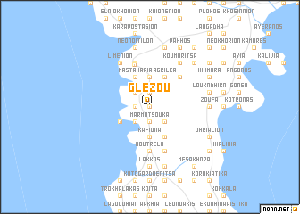
Glézou (Piraiévs, Greece)Glézou is a town in the Piraiévs region of Greece. An overview map of the region around Glézou is displayed below.
regional and 3d topo map of Glézou, Greece ::
Glézou airports ::
The nearest airport is KLX - Kalamata, located 60.2 km north west of Glézou.
Other airports nearby include KIT - Kithira (67.1 km south east), PYR - Andravida (174.9 km north west), ZTH - Zakynthos Dionysios Solomos (184.3 km north west), GPA - Patras Araxos (190.9 km north west), Nearby towns ::
Triandafilliá (0.0km north) //
Kokkinoyénis (0.0km north) //
Veloúsi (1.9km north) //
Paliópirgos (1.9km north) //
Khariá (1.9km north) //
Kalós (1.9km north) //
Pírgos Dhiroú (1.5km west) //
Mandofóros (1.5km west) //
Levkiás (1.5km west) //
Marmatsoúka (1.9km south) //
Kambinára (2.4km north west) //
Métopa (2.4km north west) //
Nikándrion (2.4km south west) //
Frangoúlias (2.4km south east) //
Xepapadhiánika (3.7km north) //
Lagokoílion (3.7km north) //
Aofalotí (3.7km south) //
Ftíon (3.7km south) //
Kafióna (3.7km south) //
Ayía Varvára (3.7km south) //
Tsópakas (3.7km south) //
Polána (3.7km south) //
Dhríalos (3.7km south) //
Mastakária (4.0km north) //
Dhirós (4.0km north) //
Omalaí (4.0km north) //
Dhriália (4.0km north) //
Agriléa (4.0km north) //
Kharoúdha (3.5km south west) //
[all distances 'as the bird flies' and approximate]  Places with similar names to Glézou, Greece ::
Disclaimer :: Information on this page comes without warranty of any kind |
||
|
Where is Glézou? Elevation and coordinates ::
Latitude (lat): 36°37'0"N Longitude (lon): 22°24'0"E
Elevation (approx.): 334m (map arrows pan, magnifying glasses zoom) |
||
|
Visiting Glézou? Hotel/Accommodation ::
Book a hotel in Glézou Travel Guide ::
Buy a travel guide for Greece rental cars ::
car rental offers GPS waypoint ::
download a GPX waypoint (PoI) of Glézou for your GPS receiver
|
||