|
search place name
|
||
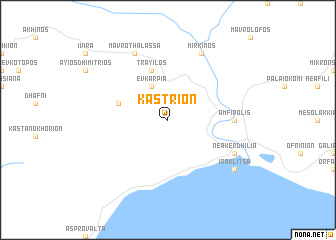
Kastríon (Piraiévs, Greece)Kastríon is a town in the Piraiévs region of Greece. An overview map of the region around Kastríon is displayed below.
regional and 3d topo map of Kastríon, Greece ::
Kastríon airports ::
The nearest airport is KVA - Kavala Megas Alexandros Intl, located 71.0 km east of Kastríon.
Other airports nearby include SKG - Thessaloniki Makedonia (77.0 km south west), LXS - Limnos (159.9 km south east), PDV - Plovdiv (163.6 km north east), LRA - Larissa Larisa (172.7 km south west), Nearby towns ::
Evkarpía (4.0km north) //
Tráyilos (5.7km north) //
Aïdhonokhórion (4.6km north west) //
Amfípolis (5.6km east) //
Mavrothálassa (7.9km north) //
Néa Kerdhília (6.7km south east) //
Mírkinos (7.9km north) //
Iraklítsa (7.9km south east) //
[all distances 'as the bird flies' and approximate] 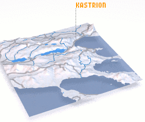 Places with similar names to Kastríon, Greece ::
// Kustrena (DE)
// Casa Torno (IT)
// Castorano (IT)
// Kostryń (PL)
// Kostiranna (EE)
// Gosturan (AL)
// Kosturino (BG)
// Kastrāne (LV)
// Guştureni (RO)
// Kostrina (UA)
Disclaimer :: Information on this page comes without warranty of any kind |
||
|
Where is Kastríon? Elevation and coordinates ::
Latitude (lat): 40°50'0"N Longitude (lon): 23°47'0"E
Elevation (approx.): 94m (map arrows pan, magnifying glasses zoom) |
||
|
Visiting Kastríon? Hotel/Accommodation ::
Book a hotel in Kastríon Travel Guide ::
Buy a travel guide for Greece rental cars ::
car rental offers GPS waypoint ::
download a GPX waypoint (PoI) of Kastríon for your GPS receiver
|
||