|
search place name
|
||
Katikhóri (Piraiévs, Greece)Katikhóri is a town in the Piraiévs region of Greece. An overview map of the region around Katikhóri is displayed below.
regional and 3d topo map of Katikhóri, Greece ::

Katikhóri airports ::
The nearest airport is JMK - Mykonos Mikonos, located 98.0 km south east of Katikhóri.
Other airports nearby include SKU - Skiros (102.0 km north), JKH - Chios (143.1 km east), JSI - Skiathos Alexandros Papadiamantis (154.8 km north west), VOL - Nea Anghialos Nea Anchialos (200.6 km north west), Nearby towns ::
Andiás (1.5km west) //
Pidhoulaíika (2.4km south west) //
Kómiton (2.4km north west) //
Áyios Evstrátios (3.7km south) //
Potámion (4.0km south) //
Elaión (4.0km south) //
Evangelístria (4.0km south) //
Evangelismós (4.0km north) //
Kapsoúrion (4.0km north) //
Mastroyiannaíoi (4.7km south west) //
Platanistós (4.7km south west) //
Epanokhórion (4.8km south west) //
Thímion (5.7km north) //
Zakhariá (5.7km north) //
Amigdhaléa (8.0km north) //
Babádhes (8.1km north west) //
Vrákhos (8.1km north west) //
Agathón (8.6km north west) //
Lenosaíoi (9.4km north west) //
[all distances 'as the bird flies' and approximate] 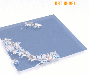 Places with similar names to Katikhóri, Greece ::
// Güdǝcühür (AZ)
// Kātkhair (BD)
// Kotkhera (IN)
// Kot Khaira (PK)
// Kot Khaira (PK)
// Kot Khaira (PK)
// Káto Khóra (GR)
// Káto Khóra (GR)
// Káto Khóra (GR)
Disclaimer :: Information on this page comes without warranty of any kind |
||
|
Where is Katikhóri? Elevation and coordinates ::
Latitude (lat): 38°3'0"N Longitude (lon): 24°33'0"E
Elevation (approx.): 539m (map arrows pan, magnifying glasses zoom) |
||
|
Visiting Katikhóri? Hotel/Accommodation ::
Book a hotel in Katikhóri Travel Guide ::
Buy a travel guide for Greece rental cars ::
car rental offers GPS waypoint ::
download a GPX waypoint (PoI) of Katikhóri for your GPS receiver
|
||