|
search place name
|
||
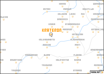
Kraterón (Piraiévs, Greece)Kraterón is a town in the Piraiévs region of Greece. An overview map of the region around Kraterón is displayed below.
regional and 3d topo map of Kraterón, Greece ::
Kraterón airports ::
The nearest airport is KSO - Kastoria Aristotelis, located 44.9 km south of Kraterón.
Other airports nearby include OHD - Ohrid (60.6 km north west), KZI - Kozani Filippos (76.8 km south east), SKP - Skopje (126.1 km north), IOA - Ioannina (134.8 km south), Nearby towns ::
Kalívia Dambítsi (2.3km south west) //
Kišava (3.7km north) //
Akrítas (4.0km south) //
Ethnikón (3.4km north east) //
Dragoš (4.6km north east) //
Parórion (4.6km north east) //
Graešnica (6.2km north east) //
Áno Klinaí (5.6km east) //
Álona (7.5km south) //
Ayía Paraskeví (6.7km north east) //
Velušina (7.9km north) //
Lažec (9.3km north east) //
Pisodhérion (9.3km south west) //
[all distances 'as the bird flies' and approximate] 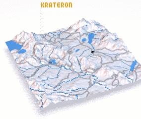 Places with similar names to Kraterón, Greece ::
// Greitern (AT)
// Kreutern (AT)
// Krøderen (NO)
// Cartieru Nou (RO)
// Cartieru Nou (RO)
// Cartieru Nou (RO)
// Cartieru Nou (RO)
// Cordăreni (RO)
// Kurtaran (TR)
// Cartirana (ES)
Disclaimer :: Information on this page comes without warranty of any kind |
||
|
Where is Kraterón? Elevation and coordinates ::
Latitude (lat): 40°51'0"N Longitude (lon): 21°19'0"E
Elevation (approx.): 958m (map arrows pan, magnifying glasses zoom) |
||
|
Visiting Kraterón? Hotel/Accommodation ::
Book a hotel in Kraterón Travel Guide ::
Buy a travel guide for Greece rental cars ::
car rental offers GPS waypoint ::
download a GPX waypoint (PoI) of Kraterón for your GPS receiver
|
||