|
search place name
|
||
Laliotaíika (Piraiévs, Greece)Laliotaíika is a town in the Piraiévs region of Greece. An overview map of the region around Laliotaíika is displayed below.
regional and 3d topo map of Laliotaíika, Greece ::

Laliotaíika airports ::
The nearest airport is KLX - Kalamata, located 115.2 km south west of Laliotaíika.
Other airports nearby include KIT - Kithira (151.1 km south), GPA - Patras Araxos (159.5 km west), PYR - Andravida (163.8 km west), JSI - Skiathos Alexandros Papadiamantis (174.7 km north), Nearby towns ::
Epáno Epídhavros (0.0km north) //
Palaiá Epídhavros (2.9km east) //
Áyios Andréas (2.9km west) //
Néa Epídhavros (4.0km north) //
Anastasopoulaíika (3.5km north west) //
Psimoulaíika (4.4km west) //
Perakaíika (4.8km north west) //
Katsavaíika (4.8km north west) //
Paralía Néas Epidhávrou (6.3km north east) //
Koliákion (7.1km south east) //
Khatziméton (8.0km south) //
Trakhiá (8.0km south) //
Koróni (6.9km south west) //
Adhámion (8.6km south west) //
Dhímaina (8.6km north west) //
[all distances 'as the bird flies' and approximate] 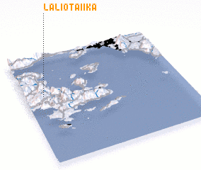 Places with similar names to Laliotaíika, Greece ::
// Lalla Outka (MA)
// Lelitków (PL)
// Leletka (UA)
// Lolotique (SV)
// Lilla Dicka (SE)
// Laletić (CS)
Disclaimer :: Information on this page comes without warranty of any kind |
||
|
Where is Laliotaíika? Elevation and coordinates ::
Latitude (lat): 37°38'0"N Longitude (lon): 23°7'0"E
Elevation (approx.): 58m (map arrows pan, magnifying glasses zoom) |
||
|
Visiting Laliotaíika? Hotel/Accommodation ::
Book a hotel in Laliotaíika Travel Guide ::
Buy a travel guide for Greece rental cars ::
car rental offers GPS waypoint ::
download a GPX waypoint (PoI) of Laliotaíika for your GPS receiver
|
||