|
search place name
|
||
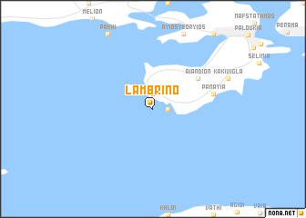
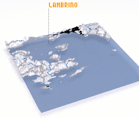
Lambrinó (Piraiévs, Greece)Lambrinó is a town in the Piraiévs region of Greece. An overview map of the region around Lambrinó is displayed below.
regional and 3d topo map of Lambrinó, Greece ::
Lambrinó airports ::
The nearest airport is JSI - Skiathos Alexandros Papadiamantis, located 143.8 km north of Lambrinó.
Other airports nearby include SKU - Skiros (152.4 km north east), KLX - Kalamata (152.7 km south west), VOL - Nea Anghialos Nea Anchialos (157.9 km north), GPA - Patras Araxos (177.3 km west), Nearby towns ::
 Places with similar names to Lambrinó, Greece ::
// La Méreune (CH)
// Lumbrein (CH)
// Lomorni (ET)
// La Marina (PA)
// La Marina (IT)
// La Mariana (CU)
// La Mariana (CU)
// La Maraña (ES)
// La Mariana (ES)
// La Marina (ES)
Disclaimer :: Information on this page comes without warranty of any kind |
||
|
Where is Lambrinó? Elevation and coordinates ::
Latitude (lat): 37°53'0"N Longitude (lon): 23°25'0"E
Elevation (approx.): -32768m (map arrows pan, magnifying glasses zoom) |
||
|
Visiting Lambrinó? Hotel/Accommodation ::
Book a hotel in Lambrinó Travel Guide ::
Buy a travel guide for Greece rental cars ::
car rental offers GPS waypoint ::
download a GPX waypoint (PoI) of Lambrinó for your GPS receiver
|
||