|
search place name
|
||
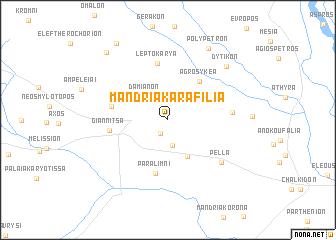
Mandriá Karafiliá (Pélla, Greece)Mandriá Karafiliá is a town in the Pélla region of Greece. An overview map of the region around Mandriá Karafiliá is displayed below.
regional and 3d topo map of Mandriá Karafiliá, Greece ::
Mandriá Karafiliá airports ::
The nearest airport is SKG - Thessaloniki Makedonia, located 53.0 km south east of Mandriá Karafiliá.
Other airports nearby include KZI - Kozani Filippos (78.1 km south west), KSO - Kastoria Aristotelis (107.7 km west), LRA - Larissa Larisa (128.0 km south), SKP - Skopje (146.8 km north west), Nearby towns ::
Archontikón (1.6km south west) //
Mandriá Kaltsá (2.3km north) //
Mesianón (2.9km south) //
Damianón (3.2km north west) //
Néa Pélla (4.4km south) //
Agrosykéa (5.1km north east) //
Paralímni (6.1km south) //
Leptokaryá (6.4km north) //
Pentaplátanon (5.1km west) //
Giannitsá (5.1km west) //
Rachóna (5.5km east) //
Pélla (6.5km south east) //
Dytikón (7.8km north east) //
Polýpetron (8.7km north east) //
Asvestareión (9.2km north west) //
(( Ánydron )) (9.6km north west) //
[all distances 'as the bird flies' and approximate] 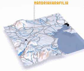 Places with similar names to Mandriá Karafiliá, Greece :: Disclaimer :: Information on this page comes without warranty of any kind |
||
|
Where is Mandriá Karafiliá? Elevation and coordinates ::
Latitude (lat): 40°48'10"N Longitude (lon): 22°27'57"E
Elevation (approx.): 104m (map arrows pan, magnifying glasses zoom) |
||
|
Visiting Mandriá Karafiliá? Hotel/Accommodation ::
Book a hotel in Mandriá Karafiliá Travel Guide ::
Buy a travel guide for Greece rental cars ::
car rental offers GPS waypoint ::
download a GPX waypoint (PoI) of Mandriá Karafiliá for your GPS receiver
|
||