|
search place name
|
||
Palamás (Piraiévs, Greece)Palamás is a town in the Piraiévs region of Greece. An overview map of the region around Palamás is displayed below.
regional and 3d topo map of Palamás, Greece ::

Palamás airports ::
The nearest airport is LRA - Larissa Larisa, located 38.7 km north east of Palamás.
Other airports nearby include VOL - Nea Anghialos Nea Anchialos (67.1 km south east), KZI - Kozani Filippos (93.3 km north), IOA - Ioannina (111.3 km west), AGQ - Agrinion (115.0 km south west), Nearby towns ::
Kalivákia (1.9km south) //
Yianníkion (4.0km south) //
Kourtíkion (4.7km north west) //
Márkos (4.7km south west) //
Vlokhós (5.6km north) //
Ermítsion (5.7km south) //
Yiakhiá (5.7km north) //
Molósi (5.7km south east) //
Áyios Dhimítrios (6.3km north east) //
Mataránga (7.6km south) //
Astrítsa (6.0km east) //
Koskinás (6.8km north west) //
Pétrinon (6.8km north east) //
Gorgovítai (9.4km south west) //
[all distances 'as the bird flies' and approximate] 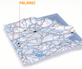 Places with similar names to Palamás, Greece ::
// Palomas (US)
// Plomosa (US)
// Plumbs (US)
// Palma Ceia (US)
// Pollmoos (DE)
// Palmas (IT)
// Palamás (GR)
// Palames (PT)
// Palmaz (PT)
// Półmieście (PL)
Disclaimer :: Information on this page comes without warranty of any kind |
||
|
Where is Palamás? Elevation and coordinates ::
Latitude (lat): 39°28'0"N Longitude (lon): 22°5'0"E
Elevation (approx.): 92m (map arrows pan, magnifying glasses zoom) |
||
|
Visiting Palamás? Hotel/Accommodation ::
Book a hotel in Palamás Travel Guide ::
Buy a travel guide for Greece rental cars ::
car rental offers GPS waypoint ::
download a GPX waypoint (PoI) of Palamás for your GPS receiver
|
||