|
search place name
|
||
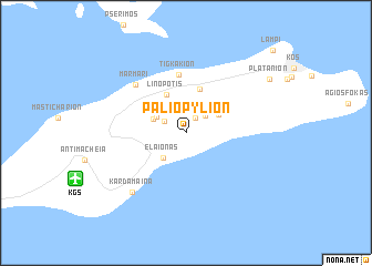
Palió Pylíon (Dodekánisos, Greece)Palió Pylíon is a town in the Dodekánisos region of Greece. An overview map of the region around Palió Pylíon is displayed below.
regional and 3d topo map of Palió Pylíon, Greece ::
Palió Pylíon airports ::
The nearest airport is KGS - Kos, located 10.0 km south west of Palió Pylíon.
Other airports nearby include LRS - Leros (52.1 km north west), RHO - Rhodos Diagoras (93.2 km south east), SMI - Samos (98.1 km north), DLM - Dalaman (143.6 km east), Nearby towns ::
Lagoúdi Zía (1.7km north east) //
Amanioú (2.1km north west) //
Asfendioú (2.4km north east) //
Ágios Geórgios (2.8km north west) //
(( Elaiónas )) (3.1km south west) //
Pylíon (3.0km north west) //
Asómatos (3.2km north east) //
Ágios Dimítrios (3.6km north east) //
Linopótis (4.1km north) //
Zipárion (4.6km north) //
Tigkákion (5.9km north) //
Marmári (6.4km north west) //
Kardámaina (7.4km south west) //
Platánion (8.6km north east) //
Lámpi (10.9km north east) //
[all distances 'as the bird flies' and approximate]  Places with similar names to Palió Pylíon, Greece ::
// Pelplin (PL)
// Pillipillini (PE)
// Pallapallane (PE)
// Palpalan (PH)
// Pilapilanay (PH)
// Pullapullani (BO)
Disclaimer :: Information on this page comes without warranty of any kind |
||
|
Where is Palió Pylíon? Elevation and coordinates ::
Latitude (lat): 36°50'6"N Longitude (lon): 27°11'29"E
Elevation (approx.): 400m (map arrows pan, magnifying glasses zoom) |
||
|
Visiting Palió Pylíon? Hotel/Accommodation ::
Book a hotel in Palió Pylíon Travel Guide ::
Buy a travel guide for Greece rental cars ::
car rental offers GPS waypoint ::
download a GPX waypoint (PoI) of Palió Pylíon for your GPS receiver
|
||