|
search place name
|
||
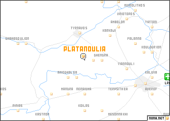
Platanoúlia (Piraiévs, Greece)Platanoúlia is a town in the Piraiévs region of Greece. An overview map of the region around Platanoúlia is displayed below.
regional and 3d topo map of Platanoúlia, Greece ::
Platanoúlia airports ::
The nearest airport is LRA - Larissa Larisa, located 14.7 km east of Platanoúlia.
Other airports nearby include VOL - Nea Anghialos Nea Anchialos (66.8 km south east), KZI - Kozani Filippos (77.6 km north west), SKG - Thessaloniki Makedonia (109.1 km north east), JSI - Skiathos Alexandros Papadiamantis (117.9 km south east), Nearby towns ::
Ayía Sofía (1.4km east) //
Dhéndra (2.9km east) //
Sinoikismós Prosfígon (4.0km south) //
Amigdhaléa (4.7km south west) //
Týrnavos (6.1km north) //
Neráïdha (7.4km south) //
Karkají (7.0km north east) //
Mándra (7.9km south) //
Terpsithéa (9.4km south east) //
Koutsókheron (9.4km south west) //
Ambelón (9.4km north east) //
[all distances 'as the bird flies' and approximate] 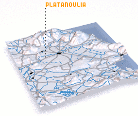 Places with similar names to Platanoúlia, Greece ::
Disclaimer :: Information on this page comes without warranty of any kind |
||
|
Where is Platanoúlia? Elevation and coordinates ::
Latitude (lat): 39°41'0"N Longitude (lon): 22°18'0"E
Elevation (approx.): 89m (map arrows pan, magnifying glasses zoom) |
||
|
Visiting Platanoúlia? Hotel/Accommodation ::
Book a hotel in Platanoúlia Travel Guide ::
Buy a travel guide for Greece rental cars ::
car rental offers GPS waypoint ::
download a GPX waypoint (PoI) of Platanoúlia for your GPS receiver
|
||