|
search place name
|
||
Salaóra (Árta, Greece)Salaóra is a town in the Árta region of Greece. An overview map of the region around Salaóra is displayed below.
regional and 3d topo map of Salaóra, Greece ::

Salaóra airports ::
The nearest airport is PVK - Preveza Aktio, located 14.7 km south west of Salaóra.
Other airports nearby include AGQ - Agrinion (64.0 km south east), IOA - Ioannina (73.7 km north), CFU - Kerkyra/corfu Ioannis Kapodistrias Intl (103.5 km north west), EFL - Keffallinia Kefallinia (106.2 km south), Nearby towns ::
Palaioskamiá (3.5km north) //
Néa Vígla (5.1km north) //
Vígla (5.8km north) //
Koronisía (5.1km south east) //
Polýdroson (7.2km north) //
Kalogerikón (7.2km north east) //
Mýtikas (7.3km north east) //
Anéza (7.9km north east) //
Apómeron (8.3km north east) //
Ayía Triás (8.8km south west) //
Neokhórion (8.8km south west) //
Áyios Thomás (10.1km south west) //
[all distances 'as the bird flies' and approximate] 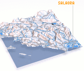 Places with similar names to Salaóra, Greece ::
Disclaimer :: Information on this page comes without warranty of any kind |
||
|
Where is Salaóra? Elevation and coordinates ::
Latitude (lat): 39°2'1"N Longitude (lon): 20°51'45"E
Elevation (approx.): 27m (map arrows pan, magnifying glasses zoom) |
||
|
Visiting Salaóra? Hotel/Accommodation ::
Book a hotel in Salaóra Travel Guide ::
Buy a travel guide for Greece rental cars ::
car rental offers GPS waypoint ::
download a GPX waypoint (PoI) of Salaóra for your GPS receiver
|
||