|
search place name
|
||
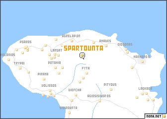
Spartoúnta (Chíos, Greece)Spartoúnta is a town in the Chíos region of Greece. An overview map of the region around Spartoúnta is displayed below.
regional and 3d topo map of Spartoúnta, Greece ::
Spartoúnta airports ::
The nearest airport is JKH - Chios, located 25.8 km south east of Spartoúnta.
Other airports nearby include MJT - Mytilini Mitilini (77.4 km north east), IGL - Izmir Cigli (88.7 km east), ADB - Izmir Adnan Menderes (105.4 km east), SMI - Samos (124.4 km south east), Nearby towns ::
Fytá (3.1km south) //
Kampiá (3.2km north) //
Kipouriaí (4.1km south) //
Víkion (4.2km north east) //
Agrelopón (4.6km north west) //
Pispiloúnta (4.1km south west) //
Ágios Geórgios (5.1km south) //
Lardáto (4.5km west) //
Leptópoda (5.0km north west) //
Amádes (5.0km north east) //
Néa Potamiá (5.3km south west) //
Kamínia (5.1km west) //
Potamiá (5.2km west) //
Kéramos (5.2km west) //
Chálandra (5.7km west) //
Agiásmata (6.7km north west) //
Afrodísia (6.1km west) //
Diefchá (8.0km south) //
Egrigóros (7.4km north west) //
Pityoús (8.3km south east) //
Piramá (8.3km south west) //
Volissós (9.1km south west) //
Chorí (9.7km south west) //
Skariótis (9.6km south west) //
Limiá (10.5km south west) //
[all distances 'as the bird flies' and approximate]  Places with similar names to Spartoúnta, Greece ::
// (( Superdente )) (LV)
Disclaimer :: Information on this page comes without warranty of any kind |
||
|
Where is Spartoúnta? Elevation and coordinates ::
Latitude (lat): 38°32'42"N Longitude (lon): 25°59'38"E
Elevation (approx.): 570m (map arrows pan, magnifying glasses zoom) |
||
|
Visiting Spartoúnta? Hotel/Accommodation ::
Book a hotel in Spartoúnta Travel Guide ::
Buy a travel guide for Greece rental cars ::
car rental offers GPS waypoint ::
download a GPX waypoint (PoI) of Spartoúnta for your GPS receiver
|
||