|
search place name
|
||
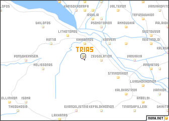
Triás (Piraiévs, Greece)Triás is a town in the Piraiévs region of Greece. An overview map of the region around Triás is displayed below.
regional and 3d topo map of Triás, Greece ::
Triás airports ::
The nearest airport is SKG - Thessaloniki Makedonia, located 66.9 km south of Triás.
Other airports nearby include KVA - Kavala Megas Alexandros Intl (116.7 km east), KZI - Kozani Filippos (148.4 km south west), SKP - Skopje (167.3 km north west), LRA - Larissa Larisa (172.5 km south west), Nearby towns ::
Zevgolatión (2.8km east) //
Khímarros (3.7km north) //
Lithótopos (6.2km north west) //
Karperí (5.6km north east) //
Psomotópion (7.9km north) //
Strimonikón (6.7km south east) //
Mirtiá (6.7km north west) //
[all distances 'as the bird flies' and approximate] 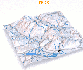 Places with similar names to Triás, Greece ::
// Douar ez Zaouia (MA)
// Douar Zaouia (MA)
// Tarasa (RU)
// Tarasy (RU)
// Tarasy (RU)
// Tarusa (RU)
// Tarusy (RU)
// Terasy (RU)
// Torres (BO)
// Torrez (BO)
Disclaimer :: Information on this page comes without warranty of any kind |
||
|
Where is Triás? Elevation and coordinates ::
Latitude (lat): 41°5'0"N Longitude (lon): 23°15'0"E
Elevation (approx.): 110m (map arrows pan, magnifying glasses zoom) |
||
|
Visiting Triás? Hotel/Accommodation ::
Book a hotel in Triás Travel Guide ::
Buy a travel guide for Greece rental cars ::
car rental offers GPS waypoint ::
download a GPX waypoint (PoI) of Triás for your GPS receiver
|
||