|
search place name
|
||
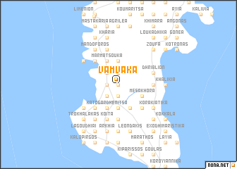
Vámvaka (Piraiévs, Greece)Vámvaka is a town in the Piraiévs region of Greece. An overview map of the region around Vámvaka is displayed below.
regional and 3d topo map of Vámvaka, Greece ::
Vámvaka airports ::
The nearest airport is KIT - Kithira, located 62.9 km south east of Vámvaka.
Other airports nearby include KLX - Kalamata (65.7 km north west), PYR - Andravida (180.4 km north west), ZTH - Zakynthos Dionysios Solomos (189.2 km north west), CHQ - Chania Souda (193.8 km south east), Nearby towns ::
Bríkion (0.0km north) //
Kotronáki (0.0km north) //
Skifiánika (1.9km north) //
Palaiokhóra (1.9km north) //
Ákia (1.9km north) //
Angiadhákion (1.5km west) //
Mína (1.9km south) //
Kouloúmion (1.5km west) //
Koutréla (1.5km west) //
Kafióna (2.4km north west) //
Ayía Varvára (2.4km north west) //
Ftíon (2.4km north west) //
Aofalotí (2.4km north west) //
Dhríalos (2.4km north west) //
Polána (2.4km north west) //
Tsópakas (2.4km north west) //
Mézapos (2.4km south west) //
Lákkos (2.4km south west) //
Érimos (2.4km south west) //
Frangoúlias (3.7km north) //
Karínia (3.7km south) //
Mésa Khóra (3.5km south east) //
Marmatsoúka (4.0km north) //
Polemítas (4.0km south) //
Káto Gardhenítsa (4.0km south) //
Áno Gardhenítsa (4.0km south) //
Pakhiánika (4.8km south east) //
Áyios Nikólaos (4.8km south east) //
Nikándrion (4.8km north west) //
[all distances 'as the bird flies' and approximate] 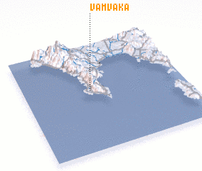 Places with similar names to Vámvaka, Greece ::
// Vamvakiá (GR)
// Vamvakiá (GR)
// Vamvakiaí (GR)
// Vamvakoú (GR)
// Vamvakoú (GR)
// Vomvokoú (GR)
// Phumĭ Ph'ak (KH)
// Phumĭ Phêk (KH)
Disclaimer :: Information on this page comes without warranty of any kind |
||
|
Where is Vámvaka? Elevation and coordinates ::
Latitude (lat): 36°34'0"N Longitude (lon): 22°25'0"E
Elevation (approx.): 361m (map arrows pan, magnifying glasses zoom) |
||
|
Visiting Vámvaka? Hotel/Accommodation ::
Book a hotel in Vámvaka Travel Guide ::
Buy a travel guide for Greece rental cars ::
car rental offers GPS waypoint ::
download a GPX waypoint (PoI) of Vámvaka for your GPS receiver
|
||