|
search place name
|
||
Aguiã (Viana do Castelo, Portugal)Aguiã is a town in the Viana do Castelo region of Portugal. An overview map of the region around Aguiã is displayed below.
regional and 3d topo map of Aguiã, Portugal ::

Aguiã airports ::
The nearest airport is VGO - Vigo, located 41.9 km north of Aguiã.
Other airports nearby include OPO - Porto (73.5 km south), VRL - Vila Real (90.1 km south east), SCQ - Santiago (112.5 km north), BGC - Braganca (143.3 km east), Nearby towns ::
Pogido (0.0km north) //
Gontilhe (1.9km south) //
Breia (1.9km south) //
Proselo (1.9km south) //
Estanque (1.9km south) //
Gondoriz (1.4km east) //
Mundão (1.4km east) //
Pinheiro (1.4km east) //
Bouça Soeiro (1.4km west) //
Riba Nogueira (1.4km west) //
Cardida (1.4km west) //
Rio de Moinhos (1.4km west) //
Rebelo (1.4km west) //
Zebra (1.9km north) //
Santos Cosme e Damião (1.9km north) //
Breia (1.9km north) //
Couto (2.3km south east) //
Enxerto (2.3km south west) //
Santins (2.3km north west) //
Lamela (2.3km north west) //
Vila Fonche (3.7km south) //
Parada (3.7km south) //
Tourim (3.7km south) //
Reboredo (2.8km west) //
Cem (2.8km west) //
Vila Nova (3.7km north) //
Telhado (3.7km north) //
Feijoal (3.7km north) //
Vilela (3.7km north) //
[all distances 'as the bird flies' and approximate] 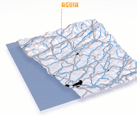 Places with similar names to Aguiã, Portugal ::
Disclaimer :: Information on this page comes without warranty of any kind |
||
|
Where is Aguiã? Elevation and coordinates ::
Latitude (lat): 41°53'0"N Longitude (lon): 8°26'0"W
Elevation (approx.): 87m (map arrows pan, magnifying glasses zoom) |
||
|
Visiting Aguiã? Hotel/Accommodation ::
Book a hotel in Aguiã Travel Guide ::
Buy a travel guide for Portugal rental cars ::
car rental offers GPS waypoint ::
download a GPX waypoint (PoI) of Aguiã for your GPS receiver
|
||