|
search place name
|
||
Ameixede (Porto, Portugal)Ameixede is a town in the Porto region of Portugal. An overview map of the region around Ameixede is displayed below.
regional and 3d topo map of Ameixede, Portugal ::

Ameixede airports ::
The nearest airport is OPO - Porto, located 36.0 km north west of Ameixede.
Other airports nearby include VRL - Vila Real (52.3 km east), VGO - Vigo (128.6 km north), BGC - Braganca (157.4 km north east), SCQ - Santiago (199.8 km north), Nearby towns ::
Curveira (NaNkm north) //
Jugueiros (1.4km east) //
Novelhos (1.4km east) //
Eja (1.9km south) //
Portela (1.9km north) //
Entre -os- Rios (1.9km south) //
Pinheiro (1.9km north) //
Abol de Cima (1.9km south) //
Torrão (2.3km south east) //
Valpedre (3.7km north) //
Carbuelo (2.8km west) //
Rio de Moinhos (2.8km east) //
Agrela (2.8km east) //
Algar (3.7km south) //
Silvosa (3.7km south) //
Cabeça Santa (4.0km north) //
Paredes (4.0km north) //
Vilarinho de Canelas (3.4km south west) //
Chaim (3.4km south east) //
Regadas (4.0km south) //
Travassos (4.0km south) //
Canelas (4.0km south) //
Bairro (4.0km south) //
Seixoso (4.6km north west) //
Ribas (4.6km north west) //
Funtão de Cima (4.6km north east) //
Vitetos de Cima (4.6km south east) //
Várzea do Douro (4.6km south east) //
Castelo de Paiva (4.6km south east) //
[all distances 'as the bird flies' and approximate] 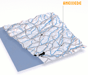
Disclaimer :: Information on this page comes without warranty of any kind |
||
|
Where is Ameixede? Elevation and coordinates ::
Latitude (lat): 41°6'0"N Longitude (lon): 8°18'0"W
Elevation (approx.): 193m (map arrows pan, magnifying glasses zoom) |
||
|
Visiting Ameixede? Hotel/Accommodation ::
Book a hotel in Ameixede Travel Guide ::
Buy a travel guide for Portugal rental cars ::
car rental offers GPS waypoint ::
download a GPX waypoint (PoI) of Ameixede for your GPS receiver
|
||